“Top_Surface”_tracksite_(SGDS.18).png
Size of this preview:
306 × 599 pixels
.
Other resolutions:
122 × 240 pixels
|
245 × 480 pixels
|
392 × 768 pixels
|
523 × 1,024 pixels
|
1,967 × 3,853 pixels
.
Summary
| Description |
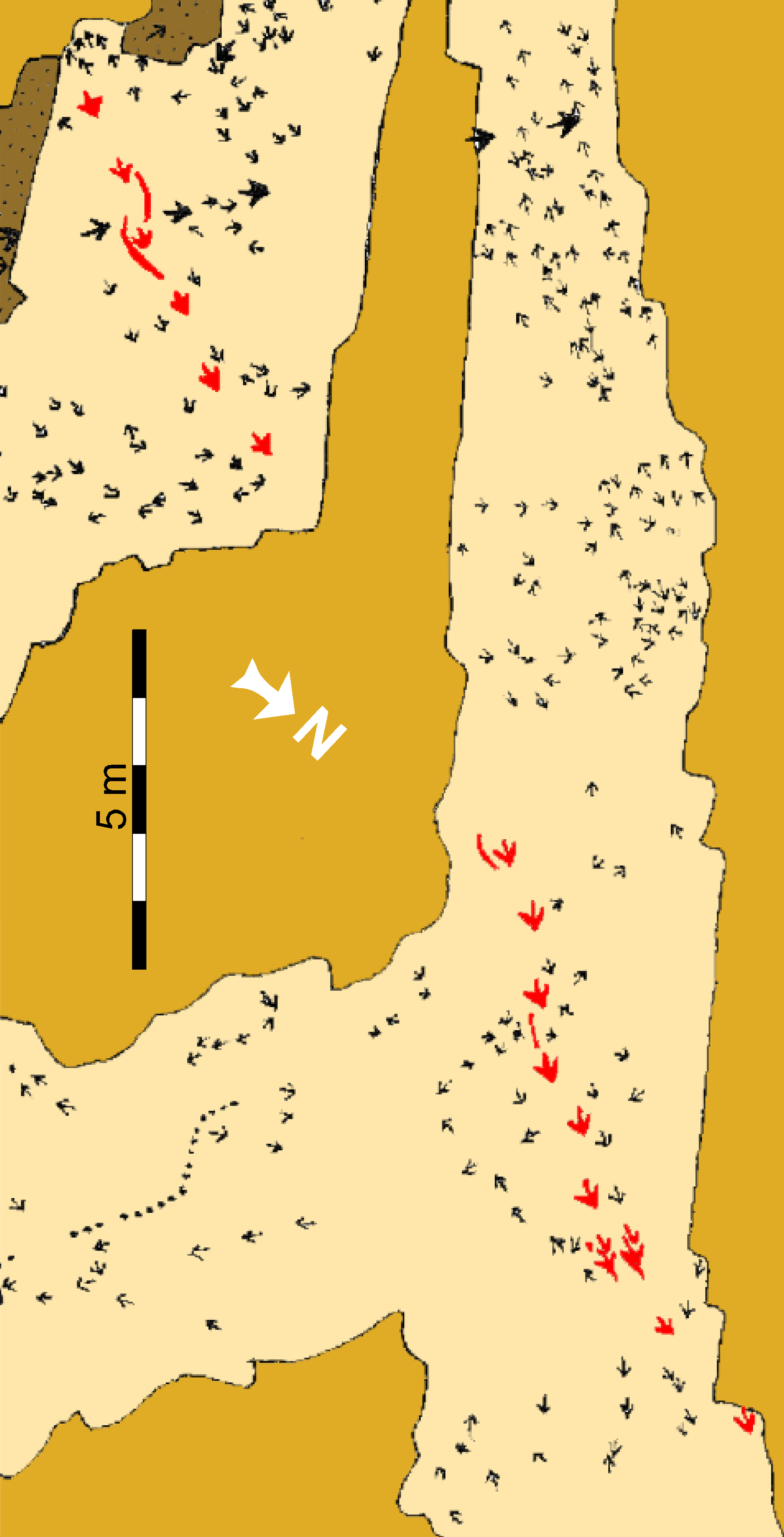
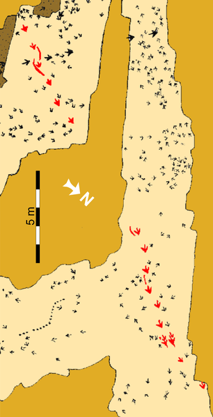
Schematic map of the “Top Surface” tracksite (SGDS.18). Beige shaded areas represent the “Top Surface” of the Main Track-bearing Sandstone Bed; gold shaded areas are unexcavated; brown areas represent areas removed after mapping to examine lower horizons. The Eubrontes trackway that includes the crouching trace is highlighted in red. |
||
| Date | |||
| Source | http://journals.plos.org/plosone/article?id=10.1371/journal.pone.0004591 | ||
| Author | Andrew R. C. Milner, Jerald D. Harris, Martin G. Lockley, James I. Kirkland, Neffra A. Matthews | ||
|
Permission
( Reusing this file ) |
|