Çatalhöyük,_7400_BC,_Konya,_Turkey_-_UNESCO_World_Heritage_Site,_08.jpg
Size of this preview:
800 × 368 pixels
.
Other resolutions:
320 × 147 pixels
|
640 × 295 pixels
|
1,024 × 472 pixels
|
1,280 × 589 pixels
|
3,648 × 1,680 pixels
.
Summary
| Description |
English:
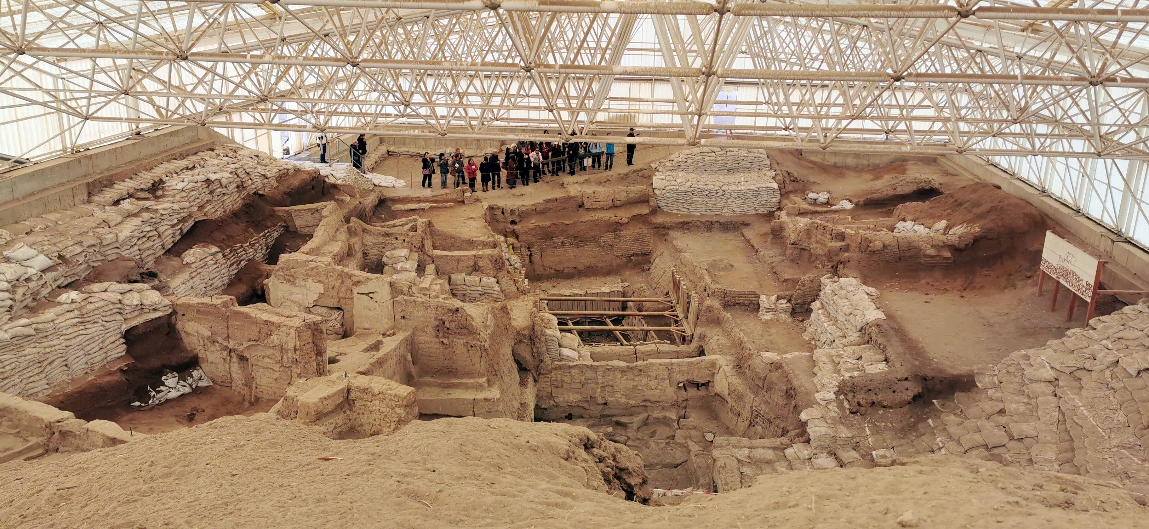
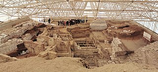
Population 5,000 - 7,000. Large numbers of buildings clustered together. The inhabitants lived in mudbrick houses. No footpaths or streets between the dwellings. Most were accessed by holes in the ceiling and doors on the side of the houses, with doors reached by ladders and stairs.
|
| Date | |
| Source | Own work |
| Author | Murat Özsoy 1958 |
| Camera location |
|
View this and other nearby images on: OpenStreetMap |
|
|---|
Licensing
I, the copyright holder of this work, hereby publish it under the following license:
This file is licensed under the
Creative Commons
Attribution-Share Alike 4.0 International
license.
-
You are free:
- to share – to copy, distribute and transmit the work
- to remix – to adapt the work
-
Under the following conditions:
- attribution – You must give appropriate credit, provide a link to the license, and indicate if changes were made. You may do so in any reasonable manner, but not in any way that suggests the licensor endorses you or your use.
- share alike – If you remix, transform, or build upon the material, you must distribute your contributions under the same or compatible license as the original.