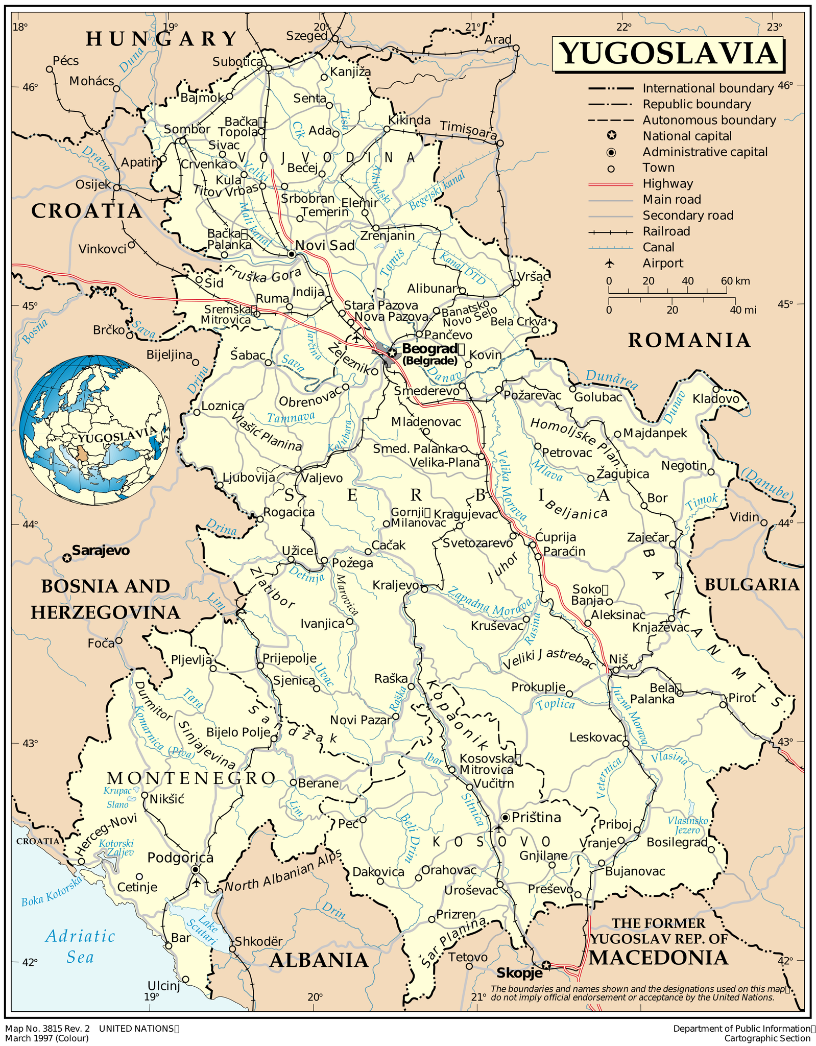
Yugoslavia_1997_UN_map.png

Size of this preview:
468 × 600 pixels
.
Other resolutions:
187 × 240 pixels
|
374 × 480 pixels
|
599 × 768 pixels
|
799 × 1,024 pixels
|
1,598 × 2,048 pixels
|
2,613 × 3,349 pixels
.
| Description |
English:
Map of Yugoslavia as of March 1997. Produced by the United Nations Cartographic Section.
Español:
Mapa de Yugoslavia a fecha marzo de 1997. Realizado por el Servicio Cartográfico de las Naciones Unidas.
|
|||
| Date | ||||
| Source | United Nations Cartographic Section | |||
| Author | United Nations Cartographic Section | |||
|
Permission
( Reusing this file ) |
|
