Xepon_-_tchepone_-_Laos_-_1962.jpg

No higher resolution available.
Summary
| Description |
English:
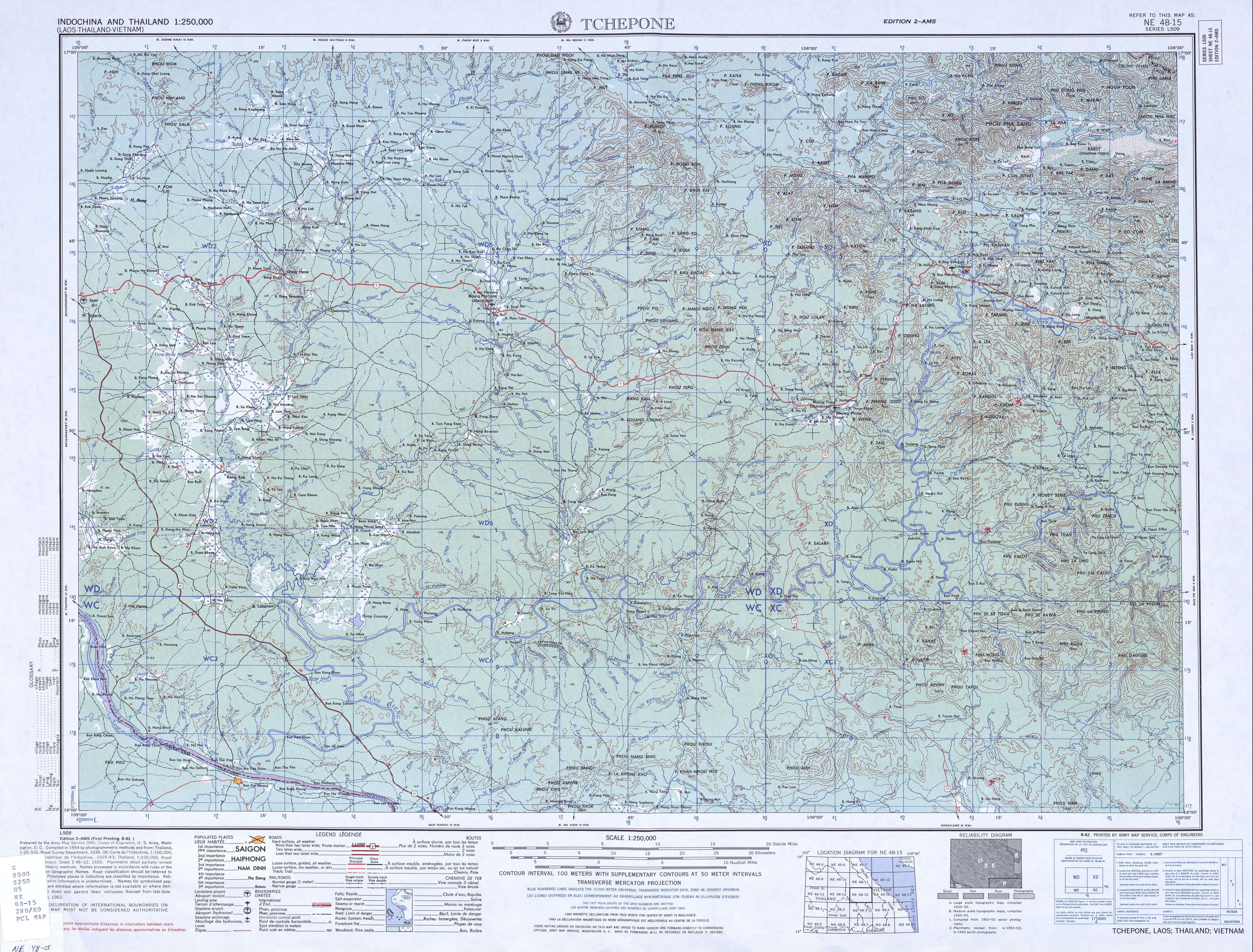
A portion of the Tchepone area map produced in 1954 and updated in 1962 showing the locatio of the village of Xépôn in Laos. Just to the northwest is an indicator showing the location of the French-built airfield.
Xépôn is also known as "Tchepone" and as "Sepon." The village was destroyed during Operation Lam Son 719 in February and March of 1971. A modern village, also known as Xépôn (or Sepon) was built near the site of the old airfield.
|
| Date | |
| Source | http://www.lib.utexas.edu/maps/ams/indochina_and_thailand/txu-oclc-6535632-ne48-15-2nd-ed.jpg |
| Author | United States Army Map Service |
Licensing
|
|
This file is a work of a
U.S. Army
soldier or employee, taken or made as part of that person's official duties. As a
work
of the
U.S. federal government
, it is in the
public domain
in the United States.
|

|