Wide_Area_Map_of_Kintetsu.png

Size of this preview:
800 × 597 pixels
.
Other resolutions:
320 × 239 pixels
|
640 × 478 pixels
|
1,024 × 765 pixels
|
1,280 × 956 pixels
|
2,148 × 1,604 pixels
.

|
This
transport map
image could be re-created
using
vector graphics
as an
SVG
file
. This has several advantages; see
Commons:Media for cleanup
for more information. If an SVG form of this image is available, please upload it and afterwards replace this template with
{{

vector version available

|

new image name

}}
.
It is recommended to name the SVG file “Wide Area Map of Kintetsu.svg”—then the template Vector version available (or Vva ) does not need the new image name parameter. |
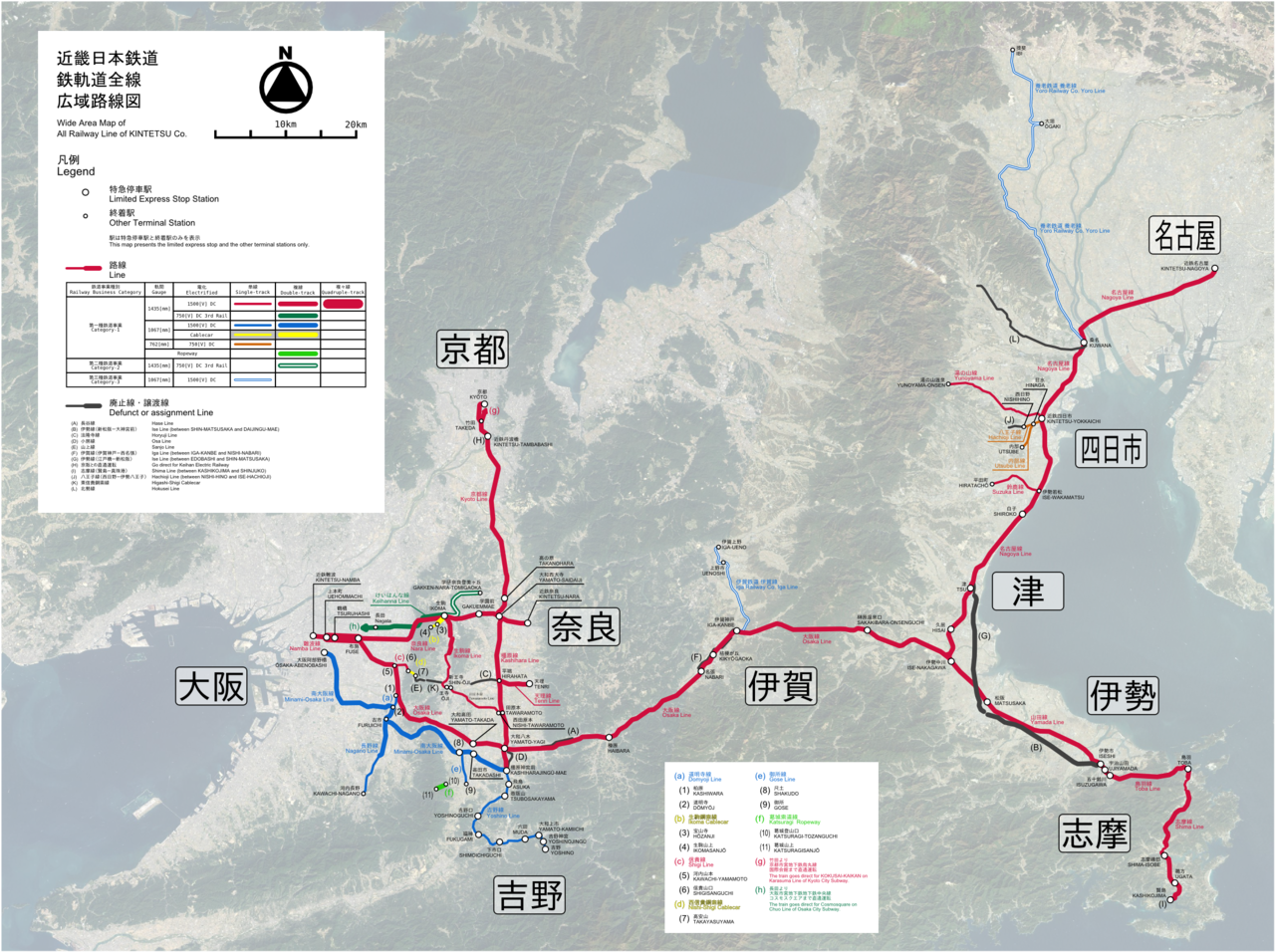
Summary
| Description |
English:
Wide area map of Kintetsu Corporation rail network
日本語:
近畿日本鉄道
鉄軌道全線広域路線図
|
| Date | |
| Source | Own work. The satellite image is from LANDSAT. |
| Author | excl-zoo |
Licensing
|
|
This work has been released into the
public domain
by its author,
excl-zoo
. This applies worldwide.
In some countries this may not be legally possible; if so:
|