Whitemarsh_Hall.jpg
No higher resolution available.
Summary
| Description |
English:
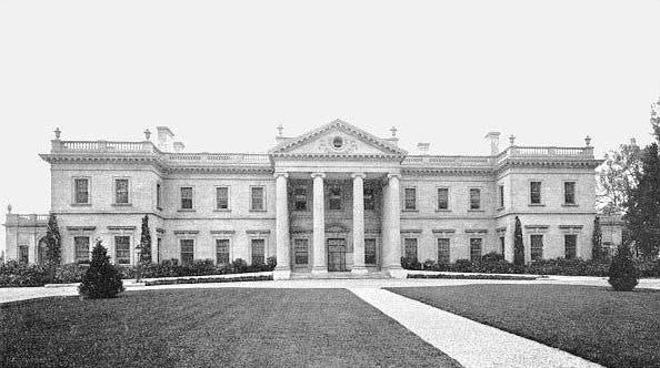
Whitemarsh Hall
,
Wyndmoor, Pennsylvania
. Designed by
Horace Trumbauer
for
Edward T. Stotesbury
.
|
| Date | House 1921 - 1980 (demolished) |
| Source | Own work |
| Author | Shipdude at en.wikipedia |
|
Permission
( Reusing this file ) |
public domain |
| Other versions | different resolution |
| Camera location |
|
View this and other nearby images on: OpenStreetMap |
|
|---|
Licensing
|
|
This work has been released into the
public domain
by its author,
Shipdude
, at the
English Wikipedia
project
. This applies worldwide.
In case this is not legally possible:
|
Original upload log
The original description page was
here
. All following user names refer to en.wikipedia.
- 2007-05-04 02:45 Shipdude 606×345× (41449 bytes) This image is my own