Wharton_Hall_-_geograph.org.uk_-_163881.jpg
No higher resolution available.
|
This is a photo of
listed building
number
1137207
.
|
Summary
| Description |
English:
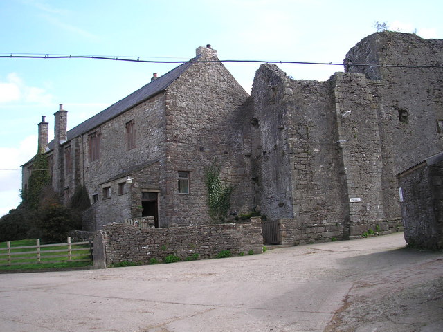
Wharton Hall. A fortified manor house dating in parts from the 14th Century. An aerial photograph is even more impressive and can be found at
http://www.visitcumbria.com/pen/whartonhall.htm
|
| Date | |
| Source | From geograph.org.uk |
| Author | John Illingworth |
|
Attribution
( required by the license ) |
John Illingworth / Wharton Hall / |
| Object location |
|
View this and other nearby images on: OpenStreetMap |
|
|---|
_heading:0.00&language=en)
Licensing

|
This image was taken from the
Geograph project
collection. See
this photograph's page
on the Geograph website for the photographer's contact details. The copyright on this image is owned by
John Illingworth
and is licensed for reuse under the
Creative Commons
Attribution-ShareAlike 2.0 license.
|
This file is licensed under the
Creative Commons
Attribution-Share Alike 2.0 Generic
license.
Attribution:
John Illingworth
-
You are free:
- to share – to copy, distribute and transmit the work
- to remix – to adapt the work
-
Under the following conditions:
- attribution – You must give appropriate credit, provide a link to the license, and indicate if changes were made. You may do so in any reasonable manner, but not in any way that suggests the licensor endorses you or your use.
- share alike – If you remix, transform, or build upon the material, you must distribute your contributions under the same or compatible license as the original.