Wallace-line1.jpg
Size of this preview:
800 × 503 pixels
.
Other resolutions:
320 × 201 pixels
|
640 × 403 pixels
|
1,024 × 644 pixels
|
1,280 × 805 pixels
|
2,560 × 1,610 pixels
|
3,685 × 2,318 pixels
.
Summary
| Description |
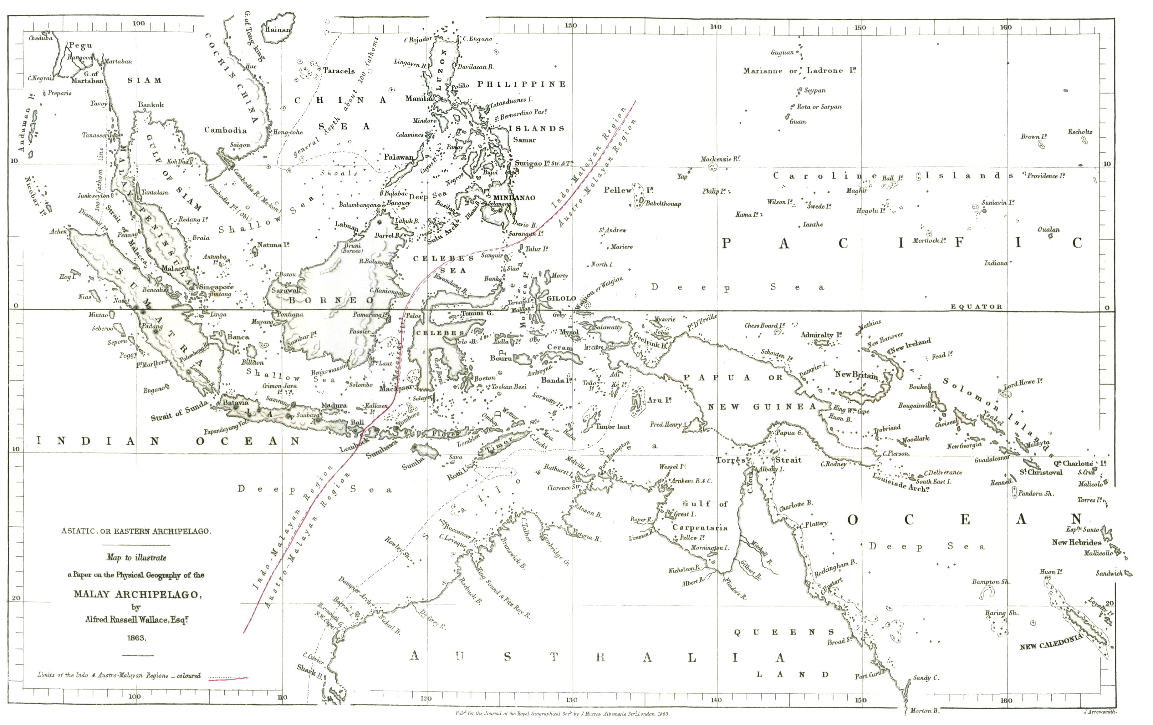
English:
The original drawing of the 'Wallace Line' showing the division between Asian and Australasian flora and fauna reproduced at
the internet archive
|
|||||||||
| Date | ||||||||||
| Source | On the Physical Geography of the Malay Archipelago | |||||||||
| Creator |
Wallace, Alfred Russel; J. Arrowsmith
|
|||||||||
| Geotemporal data | ||||||||||
| Bounding box |
|
|||||||||
| Georeferencing | ||||||||||
Licensing
|
|
This work is in the public domain in its country of origin and other countries and areas where the copyright term is the author's life plus 70 years or fewer . This work is in the public domain in the United States because it was published (or registered with the U.S. Copyright Office ) before January 1, 1929. |
| This file has been identified as being free of known restrictions under copyright law, including all related and neighboring rights. | |