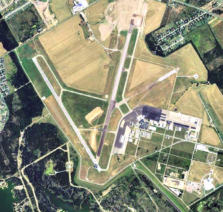
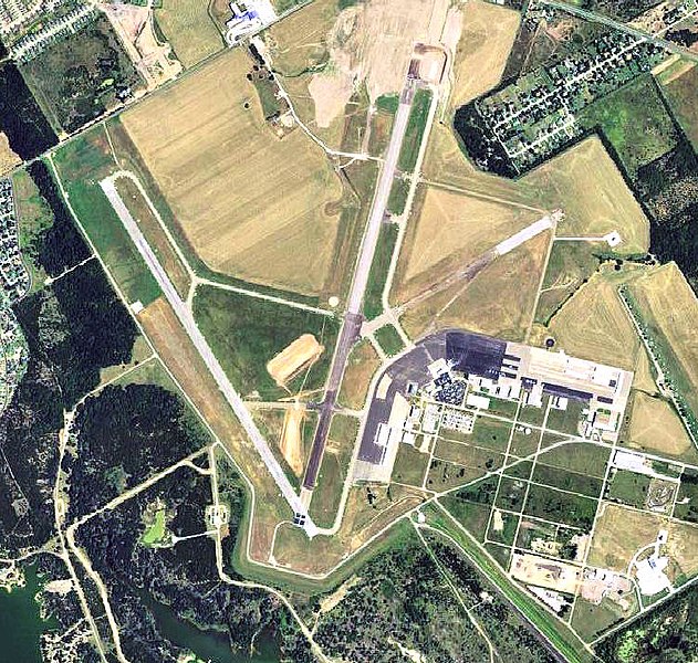
Waco_Regional_Airport_TX_2006_USGS.jpg
Size of this preview:
631 × 600 pixels
.
Other resolutions:
253 × 240 pixels
|
505 × 480 pixels
|
748 × 711 pixels
.
Summary
| Description |
English:
USGS digital
orthophoto
of
Waco Regional Airport
, formerly Blackland Army Airfield, in
Waco, Texas
, United States.
|
| Date | |
| Source |
USGS via GPSvisualizer.com |
| Author | United States Geological Survey (USGS) |
|
Permission
( Reusing this file ) |
Public domain |
| Other versions |

|
| Object location |
|
View this and other nearby images on: OpenStreetMap |
|
|---|
Licensing
|
|
This image is in the
public domain
in the United States because it only contains materials that originally came from the
United States Geological Survey
, an agency of the
United States Department of the Interior
. For more information, see
the official USGS copyright policy
.
|
|