Via_Egnatia-en.jpg

Size of this preview:
733 × 600 pixels
.
Other resolutions:
293 × 240 pixels
|
587 × 480 pixels
|
939 × 768 pixels
|
1,100 × 900 pixels
.
Summary
| Description |
English:
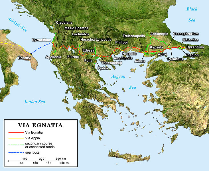
English map of the ancient Roman
Via Egnatia
crossing the South of the Balkans.
Français :
Carte en anglais de l'antique
Via Egnatia
romaine traversant le sud des Balkans.
Deutsch:
Englische Karte der Via Egnatia (griechisch Ἐγνατία Ὁδός) eine römische Straße die Adriaküste mit dem Bosporus verband
|
||
| Date | |||
| Source |
Own work;
|
||
| Author | Eric Gaba ( Sting - fr:Sting ) | ||
|
Permission
( Reusing this file ) |
|
||
| Other versions |
[
]
|


Licensing
I, the copyright holder of this work, hereby publish it under the following license:
This file is licensed under the
Creative Commons
Attribution-Share Alike 2.5 Generic
license.
-
You are free:
- to share – to copy, distribute and transmit the work
- to remix – to adapt the work
-
Under the following conditions:
- attribution – You must give appropriate credit, provide a link to the license, and indicate if changes were made. You may do so in any reasonable manner, but not in any way that suggests the licensor endorses you or your use.
- share alike – If you remix, transform, or build upon the material, you must distribute your contributions under the same or compatible license as the original.