Venezuela_en_1810.jpg
Size of this preview:
800 × 554 pixels
.
Other resolutions:
320 × 222 pixels
|
640 × 443 pixels
|
1,024 × 709 pixels
|
1,280 × 887 pixels
|
1,539 × 1,066 pixels
.
Summary
| Description |
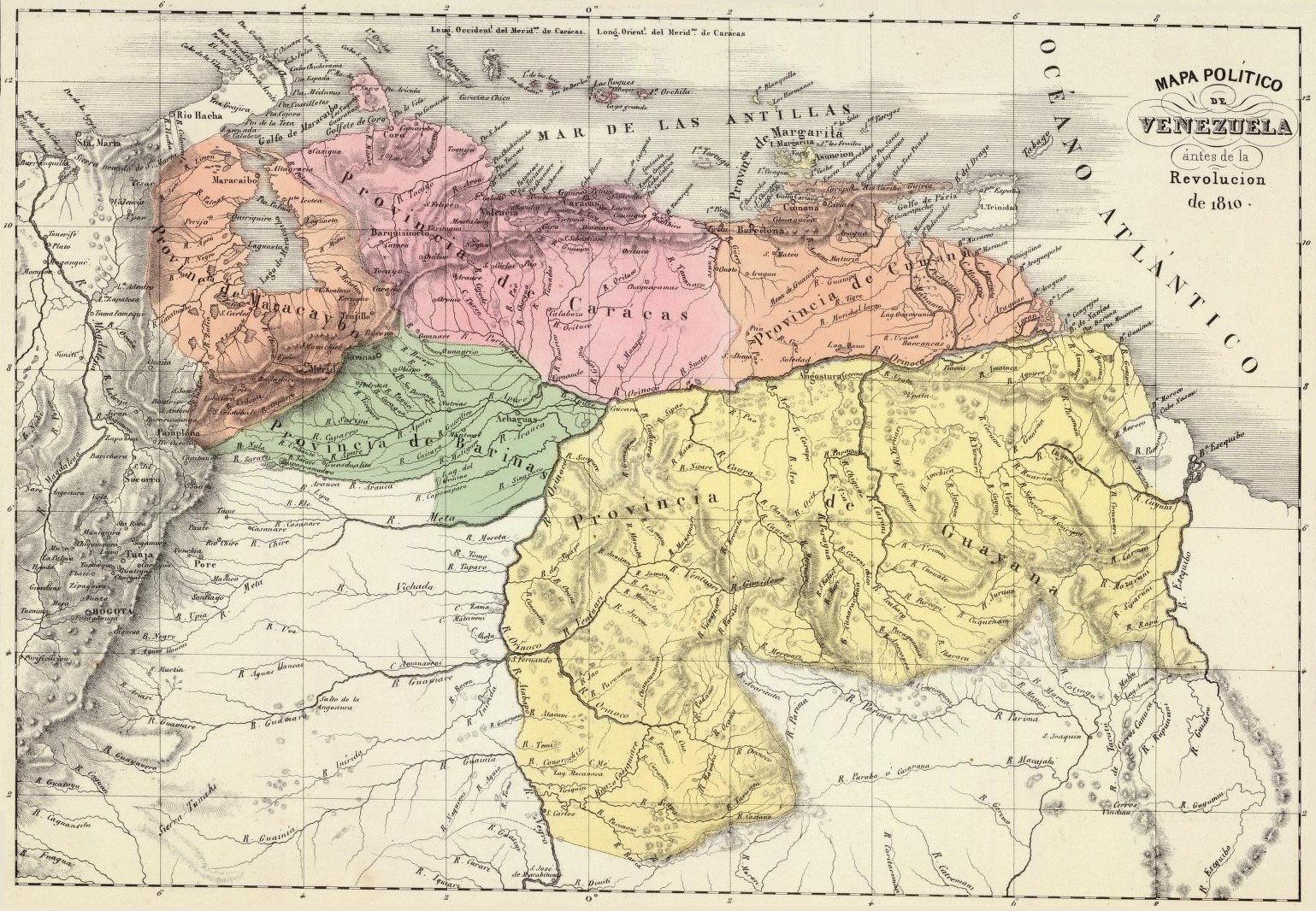
Español:
Mapa político de Venezuela en 1810. Tomado del "Atlas físico y político de la República de Venezuela", 1840.
English:
Political map of Venezuela in 1810. Taken from the "Physical and Political Atlas of the Republic of Venezuela", by Agustín Codazzi, 1840.
Português:
Mapa político da Venezuela em 1810. Extraído do "Atlas físico y político da República da Venezuela", pelo Agustín Codazzi, 1840.
Français :
Carte politique du Venezuela en 1810. Extrait de l'Atlas physique et politique de la République du Venezuela, par Agustín Codazzi, 1840.
Nederlands:
Politieke kaart van Venezuela in 1810. Genomen uit de fysieke en politieke atlas van de Republiek Venezuela, door Agustín Codazzi, 1840.
|
||||||||||||||||||||
| Date | |||||||||||||||||||||
| Source | Historical Maps by Agustín Codazzi, from David Rumsey Website | ||||||||||||||||||||
| Author |
|
||||||||||||||||||||

Licensing
|
|
This work is in the public domain in its country of origin and other countries and areas where the copyright term is the author's life plus 100 years or fewer . |
| This file has been identified as being free of known restrictions under copyright law, including all related and neighboring rights. | |