UserKTrimble-AP_of_Bagnell_Dam_MO_2011-03-01.jpg
Size of this preview:
800 × 531 pixels
.
Other resolutions:
320 × 213 pixels
|
640 × 425 pixels
|
1,024 × 680 pixels
|
1,280 × 850 pixels
|
2,560 × 1,700 pixels
|
4,288 × 2,848 pixels
.
|
|
This is an image of a place or building that is listed on the
National Register of Historic Places
in the
United States of America
. Its reference number is
8000822
.
|
Summary
| Description |
English:
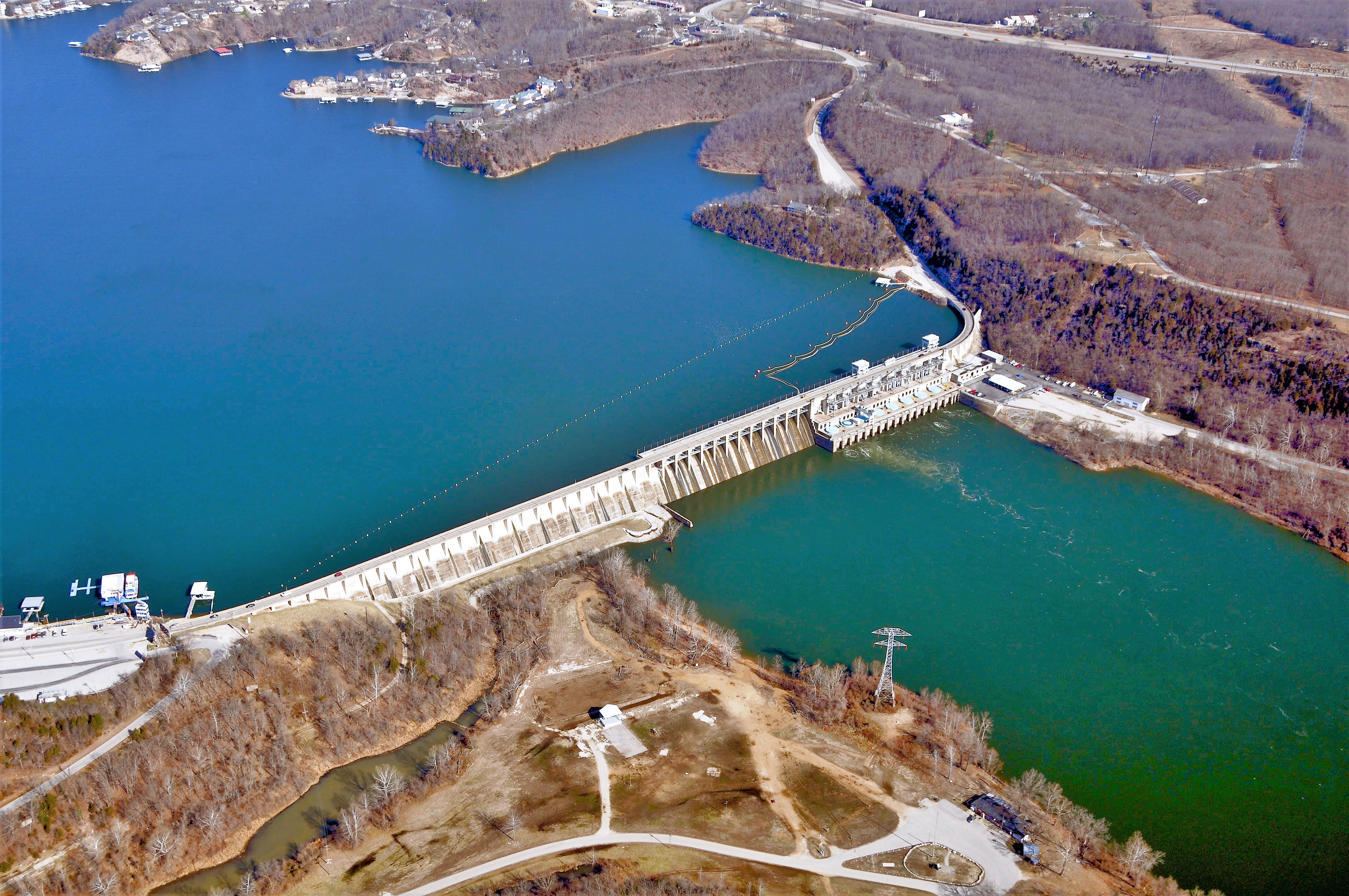
Aerial Photograph of Bagnell Dam, Lake of the Ozarks-Osage River, Missouri
|
| Date | (UTC) |
| Source | Own work ( Original text: I ( KTrimble ( talk )) created this work entirely by myself. ) |
| Author | KTrimble ( talk ) |
| Object location |
|
View this and other nearby images on: OpenStreetMap |
|
|---|
Licensing
KTrimble
at
English Wikipedia
, the copyright holder of this work, hereby publishes it under the following license:
|
|
This file is made available under the Creative Commons CC0 1.0 Universal Public Domain Dedication . |
|
The person who associated a work with this deed has dedicated the work to the
public domain
by waiving all of their rights to the work worldwide under copyright law, including all related and neighboring rights, to the extent allowed by law. You can copy, modify, distribute and perform the work, even for commercial purposes, all without asking permission.
|
Original upload log
The original description page was
here
. All following user names refer to en.wikipedia.
- 2011-03-02 03:48 KTrimble 4288×2848 (2313581 bytes) {{Information |Description = Aerial Photograph of Bagnell Dam, Lake of the Ozarks-Osage River, Missouri |Source = I (~~~) created this work entirely by myself. |Date = ~~~~~ |Author = ~~~ |other_versions = }}