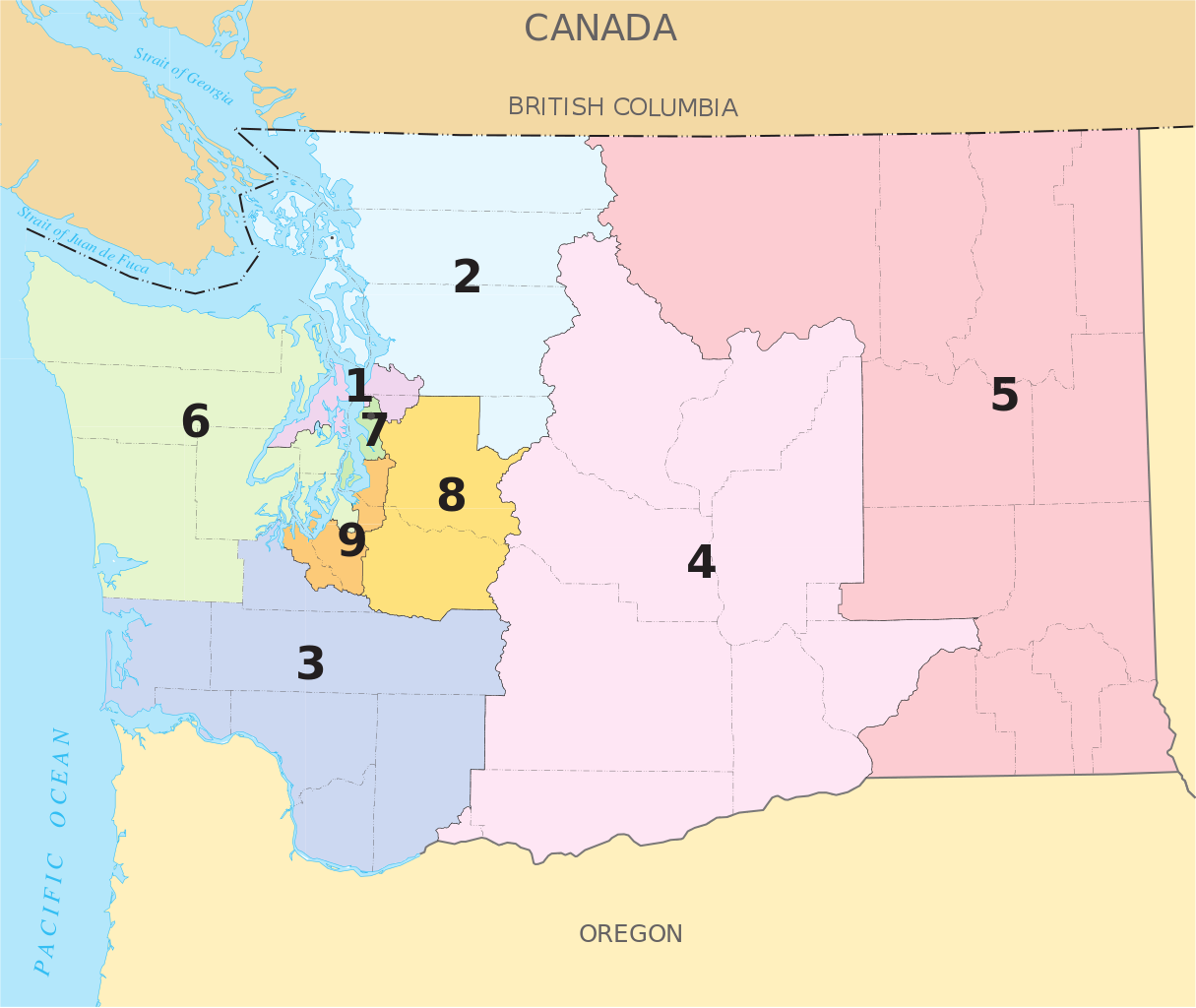
United_States_House_of_Representatives,_Washington_District_simplified_map.svg

Size of this PNG preview of this SVG file:
712 × 600 pixels
.
Other resolutions:
285 × 240 pixels
|
570 × 480 pixels
|
912 × 768 pixels
|
1,215 × 1,024 pixels
|
2,431 × 2,048 pixels
|
743 × 626 pixels
.
Summary
| Description |
English:
A map of the pre-2012 redistricting
w:Congressional districts of Washington
.
|
|||
| Date | ||||
| Source | The map is from nationalatlas.gov , specifically the PDF Map of Washington's Congressional Districts . | |||
| Author | U.S. Government | |||
|
Permission
( Reusing this file ) |
|
This map is based on File:United States House of Representatives, Washington District map.svg , but with larger district numbers, and county and town names stripped out in hopes of making something that scales down well.
Licensing
|
|
This map was obtained from an edition of the
National Atlas of the United States
. Like almost all works of the U.S. federal government, works from the
National Atlas
are in the
public domain
in the United States.
Online access: NationalAtlas.gov | 1970 print edition: Library of Congress , Perry-Castañeda Library
|
|