Ula_2016-01-10_0205Z.jpg

Size of this preview:
450 × 600 pixels
.
Other resolutions:
180 × 240 pixels
|
360 × 480 pixels
|
576 × 768 pixels
|
768 × 1,024 pixels
|
1,536 × 2,048 pixels
|
4,650 × 6,200 pixels
.
Summary
| Description |
English:
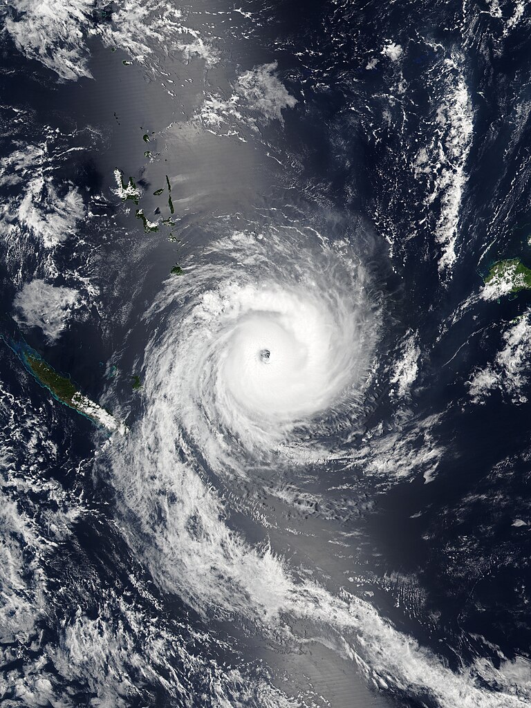
Severe Tropical Cyclone Ula east of the Tafea Province of Vanuatu on 10 January 2016.
|
| Date | |
| Source | EOSDIS Worldview |
| Author | VIIRS image captured by NOAA’s Suomi NPP satellite |
| Camera location |
|
View this and other nearby images on: OpenStreetMap |
|
|---|
Licensing
|
|
This file is in the public domain in the United States because it was solely created by NASA . NASA copyright policy states that "NASA material is not protected by copyright unless noted ". (See Template:PD-USGov , NASA copyright policy page or JPL Image Use Policy .) |
|

|
Warnings:
|