US_landings.jpg
Size of this preview:
800 × 562 pixels
.
Other resolutions:
320 × 225 pixels
|
640 × 449 pixels
|
1,024 × 719 pixels
|
1,280 × 899 pixels
|
1,995 × 1,401 pixels
.
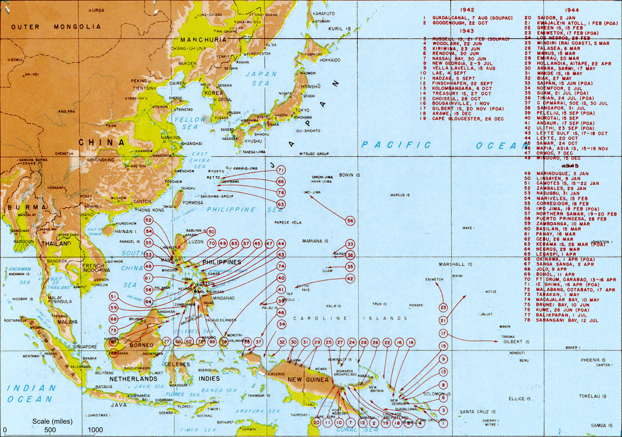
| Description | Map titled "Allied landings — August 1942 to August 1945", plate #126. It should be noted that while the title of the image is "US Landings" the map also indicates the position of many landings by Australian troops (at least) so should be referred to as "Allied landings". | |||
| Date | circa 1950 | |||
| Source | MacArthur, Douglas (1994) [1950] Reports of General MacArthur , Vol. 1, Center of Military History, pp. p. 432. Archived from the original on 12 February 2009. Retrieved on 24 February 2009. | |||
| Author | General MacArthur's General Staff | |||
|
Permission
( Reusing this file ) |
|
|||
| Other versions |
Derivative works of this file: US landings saipan.jpg
|


Transfer log
- Transfered from Wikipedia image of same name. Text above copied from Wikipedia. Performed by Mak 21:58, 29 May 2006 (UTC)