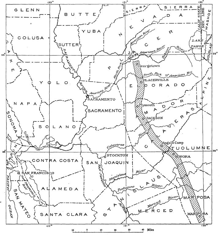
USGS_map_of_the_Mother_Lode_belt_in_California.jpg
Size of this preview:
563 × 600 pixels
.
Other resolutions:
225 × 240 pixels
|
451 × 480 pixels
|
719 × 766 pixels
.
Summary
| Description |
English:
USGS map of the Mother Lode belt in California
|
| Date | |
| Source | The Mother Lode System of California, USGS Professional Paper 157, https://pubs.usgs.gov/pp/0157/report.pdf |
| Author | Adolf Knopf |
Licensing
|
|
This image is in the
public domain
in the United States because it only contains materials that originally came from the
United States Geological Survey
, an agency of the
United States Department of the Interior
. For more information, see
the official USGS copyright policy
.
|
|