USGS_Intensity_Map_January_1_2024_Anamizu_Earthquake_M_7.5.pdf
Size of this JPG preview of this PDF file:
480 × 599 pixels
.
Other resolutions:
192 × 240 pixels
|
384 × 480 pixels
|
615 × 768 pixels
|
1,231 × 1,537 pixels
.
Summary
| Description |
English:
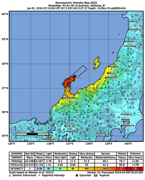
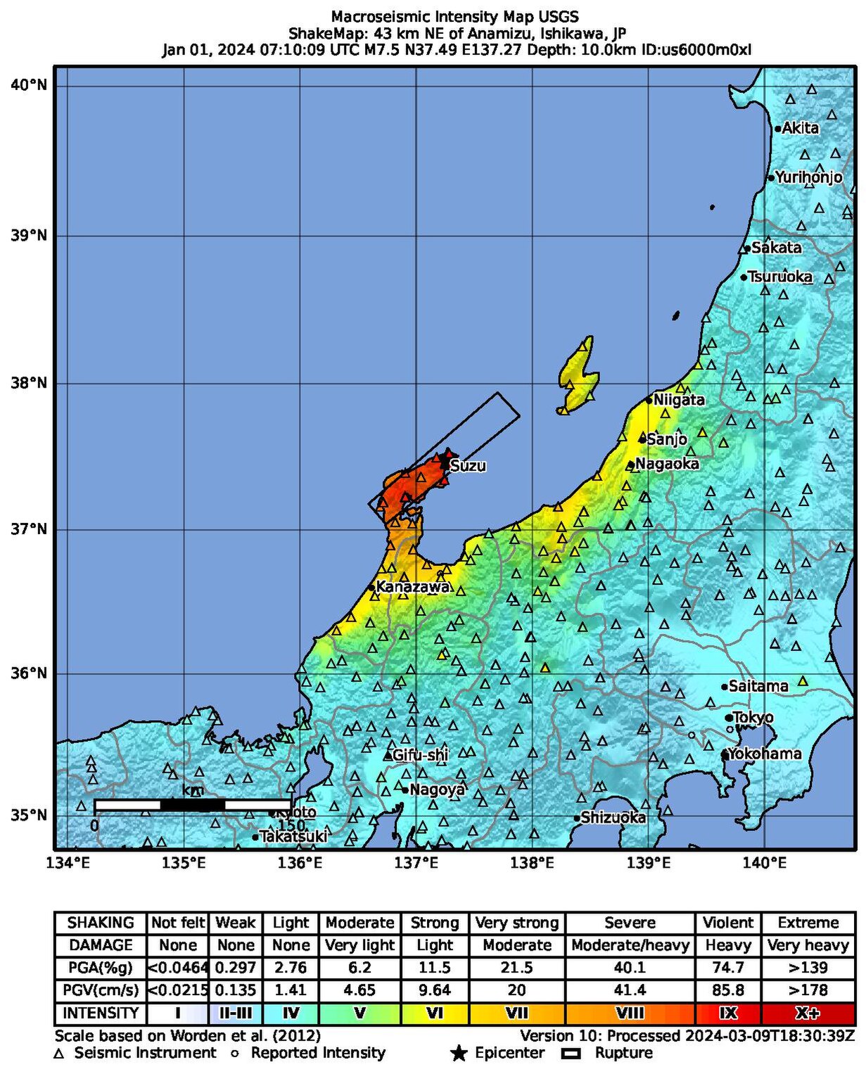
Macroseismic Intensity Map USGS
ShakeMap: 42 km NE of Anamizu, Ishikawa, JP Jan 01, 2024 07:10:09 UTC M7.5 N37.50 E137.24 Depth: 10.0km ID:us6000m0xl |
| Date | |
| Source | https://earthquake.usgs.gov/product/shakemap/us6000m0xl/us/1710009202676/download/intensity.pdf |
| Author | United States Geological Survey |
Most up-to-date maps:
https://earthquake.usgs.gov/earthquakes/eventpage/us6000m0xl/shakemap/intensity
Licensing
|
|
This image is in the
public domain
in the United States because it only contains materials that originally came from the
United States Geological Survey
, an agency of the
United States Department of the Interior
. For more information, see
the official USGS copyright policy
.
|
|