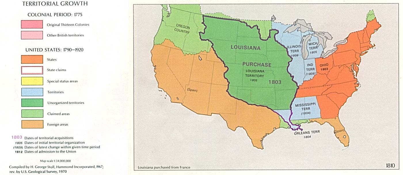
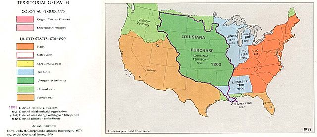
USA_Territorial_Growth_1810.jpg
Size of this preview:
800 × 347 pixels
.
Other resolutions:
320 × 139 pixels
|
640 × 278 pixels
|
1,400 × 608 pixels
.

|
This
historical map
image could be re-created
using
vector graphics
as an
SVG
file
. This has several advantages; see
Commons:Media for cleanup
for more information. If an SVG form of this image is available, please upload it and afterwards replace this template with
{{

vector version available

|

new image name

}}
.
It is recommended to name the SVG file “USA Territorial Growth 1810.svg”—then the template Vector version available (or Vva ) does not need the new image name parameter. |


1970 USGS map
|
|
This image is in the
public domain
in the United States because it only contains materials that originally came from the
United States Geological Survey
, an agency of the
United States Department of the Interior
. For more information, see
the official USGS copyright policy
.
|
|
| US growth maps |
| Animated: large · small |
| Years |
| 1775 · 1790 · 1800 · 1810 · 1820 · 1830 · 1840 · 1850 · 1860 · 1870 · 1880 · 1900 · 1920 |