USACE_Dexter_Lake_and_Dam.jpg
Size of this preview:
800 × 524 pixels
.
Other resolutions:
320 × 210 pixels
|
640 × 419 pixels
|
1,024 × 671 pixels
|
1,500 × 983 pixels
.
| Description |
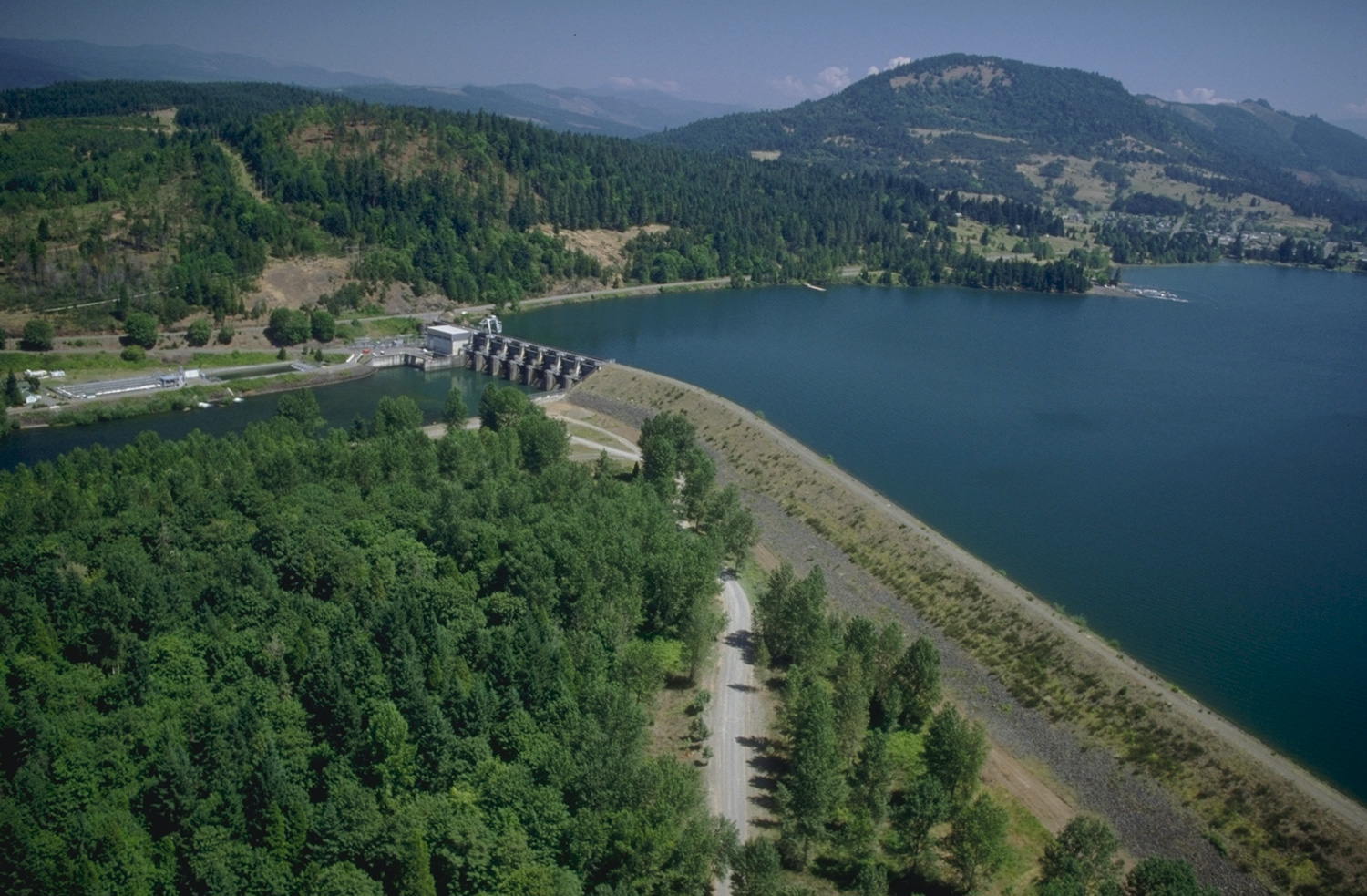
English:
Aerial view of Dexter Lake and Dam on the Middle Fork Willamette River in Lane County, Oregon, with the city of Lowell visible in the upper right. The dam is located in Lane County approximately 16 miles (26 km) southeast of Eugene, Oregon.
U.S. Army Corps of Engineers website on Dexter Lake |
|||
| Location |
Dexter, Lane County, Oregon, USA
43°55′23.99″N 122°48′20.83″W / 43.9233306°N 122.8057861°W |
|||
| Date | ||||
| Source |
U.S. Army Corps of Engineers Digital Visual Library
Image page Image description page Digital Visual Library home page |
|||
| Author | Bob Heims, U.S. Army Corps of Engineers | |||
|
Permission
( Reusing this file ) |
|