Typhoon_Etau_2003.jpg

Size of this preview:
523 × 600 pixels
.
Other resolutions:
209 × 240 pixels
|
418 × 480 pixels
|
669 × 768 pixels
|
893 × 1,024 pixels
|
1,785 × 2,048 pixels
|
6,800 × 7,800 pixels
.
| Warning | The original file is very high-resolution. It might not load properly or could cause your browser to freeze when opened at full size. |
|---|
Summary
| Description |
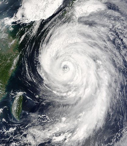
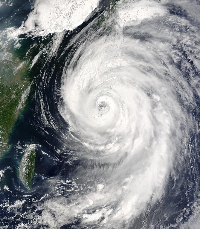
The MODIS instrument onboard NASA’s Terra spacecraft captured this bird’s-eye view of Typhoon Etau as it was buffeting the southern island chain of Okinawa, affecting airlines, a refinery and other industries. In this image the center of Etau is located just north of Nago city and is moving north at 20 kilometers per hour with sustained winds of 144 kilometers per hour. Forecasters are predicting the storm will reach Kagoshima city on Kyushu island tomorrow and then veer off to the Sea of Japan, avoiding Tokyo. |
|||||
| Date | ||||||
| Source | http://visibleearth.nasa.gov/view_rec.php?id=5719 | |||||
| Author | Jacques Descloitres, MODIS Rapid Response Team, NASA/GSFC | |||||
|
Permission
( Reusing this file ) |
|
