Txu-oclc-10552568-nh50-14.jpg
Size of this preview:
796 × 600 pixels
.
Other resolutions:
319 × 240 pixels
|
637 × 480 pixels
|
1,020 × 768 pixels
|
1,280 × 964 pixels
|
2,560 × 1,929 pixels
|
5,000 × 3,767 pixels
.
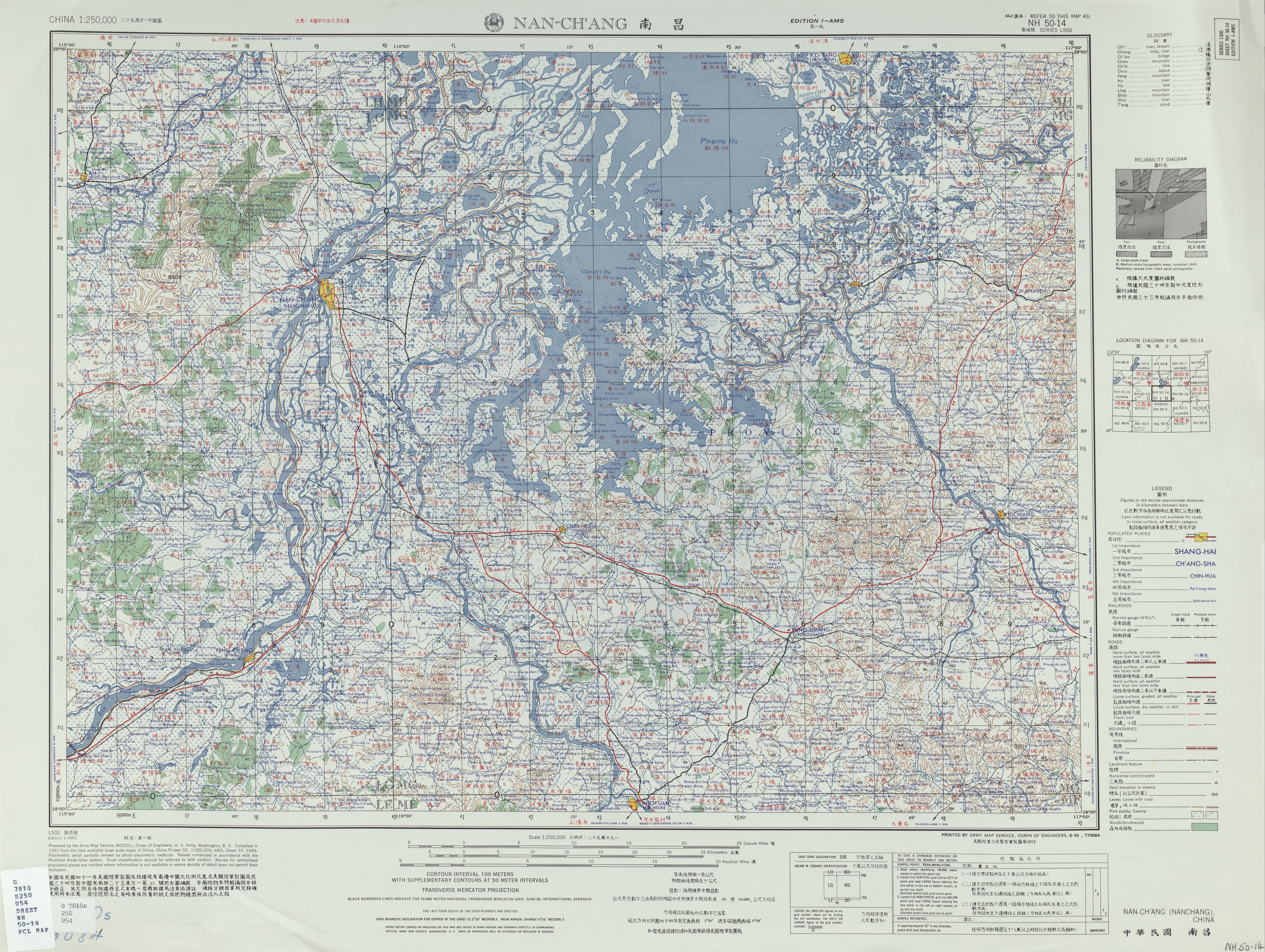
Summary
| Description |
English:
Map of
Nanchang
(Nan-ch'ang) and surrounding region, in the China AMS Topographic Maps series
|
| Date | |
| Source | Courtesy of the University of Texas Libraries, The University of Texas at Austin . ( [1] ) |
| Author | Army Map Service (NSCOL), Corps of Engineers , 1952 |
| Other versions |
|

![[1]](http://legacy.lib.utexas.edu/maps/ams/china/txu-oclc-10552568-nh50-14.jpg)
Licensing
|
|
This image or file is a work of a
U.S. Army Corps of Engineers
soldier or employee, taken or made as part of that person's official duties. As a
work
of the
U.S. federal government
, the image is in the
public domain
.
|
|