Trou_au_Natron_caldera_satellite_photo.jpg
Size of this preview:
800 × 531 pixels
.
Other resolutions:
320 × 213 pixels
|
640 × 425 pixels
|
1,024 × 680 pixels
|
1,280 × 850 pixels
|
2,560 × 1,700 pixels
|
4,288 × 2,848 pixels
.
Summary
| Description |
English:
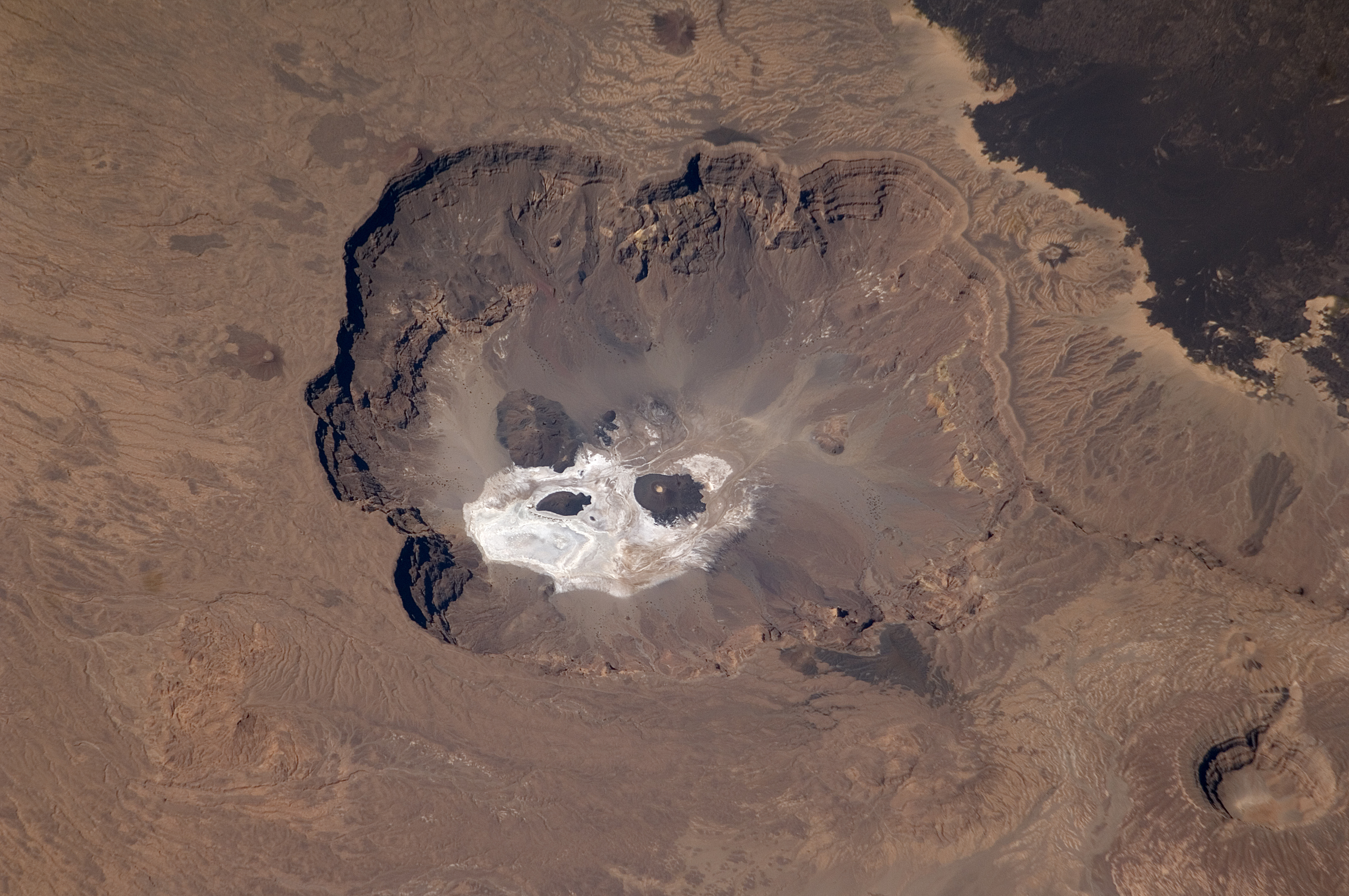
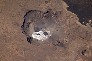
Satellite image of Trou au Natron caldera in Chad.
|
| Date | Taken on 29 October 2008, 10:13:55 UTC |
| Source | https://eol.jsc.nasa.gov/SearchPhotos/photo.pl?mission=ISS018&roll=E&frame=6047 |
| Author | NASA |
| Other versions |
|
| Camera location |
|
View this and other nearby images on: OpenStreetMap |
|
|---|
|
|
This image or video was catalogued by Johnson Space Center of the United States
National Aeronautics and Space Administration
(NASA) under
Photo ID:
ISS018-E-6047
.
This tag does not indicate the copyright status of the attached work. A normal copyright tag is still required. See Commons:Licensing .
Other languages:
|
|
Licensing
|
|
This file is in the
public domain
in the United States because it was created by the Image Science & Analysis Laboratory, of the
NASA
Johnson Space Center. NASA copyright policy states that "NASA material is not protected by copyright
unless noted
". (
NASA media use guidelines
or
Conditions of Use of Astronaut Photographs
).
Photo source:
ISS018-E-6047
.
|