|
Description
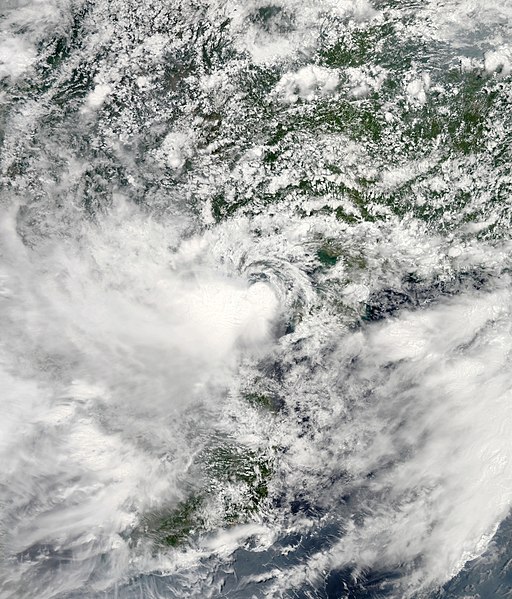
Tropical Storm Bebinca 2013-06-23 0610Z.jpg
|
English:
The Moderate Resolution Imaging Spectroradiometer (MODIS) on NASA’s Aqua satellite captured this natural-color image of Tropical Storm Bebinca, 05w (PAGASA name: Fabian) on June 23, 2013 at 06:12 UTC. At that time as shown in the image, Bebinca was over the Gulf of Tonkin, and was moving at 10km/h northwest, nearing landfall over northern Vietnam as a weak Tropical Storm. Since it's formation from a convective inflow consisting of thunderclouds of Tropical Storm Leepi which organized into TC05w in the South China Sea, Bebinca has been pounded by moderate vertical wind shear from the east, causing it's low level circulation center to become exposed, half exposed, or often just under the cover of a central dense overcast, and pushing all it's thick convection to the west of the LLCC.
|

