TriangleRegionNumbered.PNG

Legend
|
A
- Raleigh, North Carolina
|
1
- Wake County, North Carolina
a
- Research Triangle Park
|
1
- I-40/I-85
1
- US-15
|
Summary
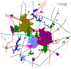
Map created by Seth Ilys and modified by Gooday.1 .
The above map covers the Research Triangle region, centered roughly on the location of the Raleigh-Durham International Airport; the circle extends approximately 25 miles outwards.
en:File:TriangleRegionNumbered.PNG by Gooday.1, 2/8/2007 22:38 (UTC)
Licensing
|
|
This file is licensed under the Creative Commons Attribution-Share Alike 3.0 Unported license. Subject to disclaimers . | |
| Attribution: Gooday.1 at the English-language Wikipedia | ||
|
||
| This licensing tag was added to this file as part of the GFDL licensing update . |

|
Permission is granted to copy, distribute and/or modify this document under the terms of the GNU Free Documentation License , Version 1.2 or any later version published by the Free Software Foundation ; with no Invariant Sections, no Front-Cover Texts, and no Back-Cover Texts. A copy of the license is included in the section entitled GNU Free Documentation License . Subject to disclaimers . |