Track_of_Railway,_from_Ingleby_Incline_at_Bank_Foot_Farm_-_geograph.org.uk_-_1594044.jpg
No higher resolution available.
| Description |
English:
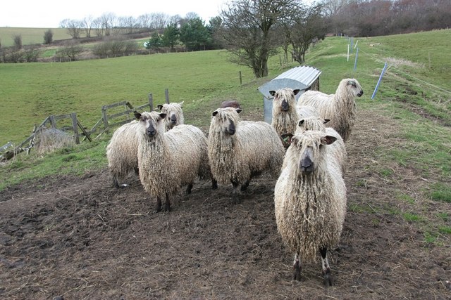
Track of Railway, from Ingleby Incline at Bank Foot Farm, near to Ingleby Greenhow, North Yorkshire, Great Britain. Now a feeding point for a small flock of Teeswater sheep, the raised bed of the old railway line can clearly be seen heading towards the trees in the background. The line originally joined what is now the Esk Valley at nearby Battersby Junction.
|
||
| Date | |||
| Source | From geograph.org.uk | ||
| Author | Paul Buckingham | ||
|
Permission
( Reusing this file ) |
This file is licensed under the
Creative Commons
Attribution-Share Alike 2.0 Generic
license.
Attribution:
Paul Buckingham
|
||
|
Attribution
( required by the license ) |
Paul Buckingham / Track of Railway, from Ingleby Incline at Bank Foot Farm / | ||

| Camera location |
|
View this and other nearby images on: OpenStreetMap |
|
|---|
| Object location |
|
View this and other nearby images on: OpenStreetMap |
|
|---|
_region:GB-GBN_heading:337.00&language=en)