Toronto_Zoo_map.png


Description
English: 
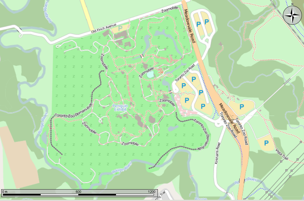
Open Street Map made in the Marble program showing the Toronto Zoo. Also shows the location of the former Toronto Zoo Domain ride. Can also be seen in Open Street Map http://www.openstreetmap.org/?mlat=43.820278&mlon=-79.182778&zoom=15&layers=M at a lower zoom level, for anyone that doesn't believe that I made this in Marble...
Date
Source Own work Made using the Marble program
Author Own work
Permission
( Reusing this file )
w:en:Creative Commons
attribution share alike
This file is licensed under the Creative Commons Attribution-Share Alike 2.5 Canada license.
You are free:
  • to share – to copy, distribute and transmit the work
  • to remix – to adapt the work
Under the following conditions:
  • attribution – You must give appropriate credit, provide a link to the license, and indicate if changes were made. You may do so in any reasonable manner, but not in any way that suggests the licensor endorses you or your use.
  • share alike – If you remix, transform, or build upon the material, you must distribute your contributions under the same or compatible license as the original.
and
GNU head This library is free software ; you can redistribute it and/or modify it under the terms of the GNU Lesser General Public License as published by the Free Software Foundation ; either version 2.1 of the License, or (at your option) any later version. This library is distributed in the hope that it will be useful, but without any warranty ; without even the implied warranty of merchantability or fitness for a particular purpose . See version 2.1 and version 3 of the GNU Lesser General Public License for more details.
for portions of the Marble program shown

Captions

Add a one-line explanation of what this file represents

Items portrayed in this file

depicts

21 July 2013