Topographic_Map_of_Gale_Crater.jpg

Size of this preview:
561 × 599 pixels
.
Other resolutions:
225 × 240 pixels
|
449 × 480 pixels
|
719 × 768 pixels
|
959 × 1,024 pixels
|
1,918 × 2,048 pixels
|
4,000 × 4,272 pixels
.
Summary
| Description |
English:
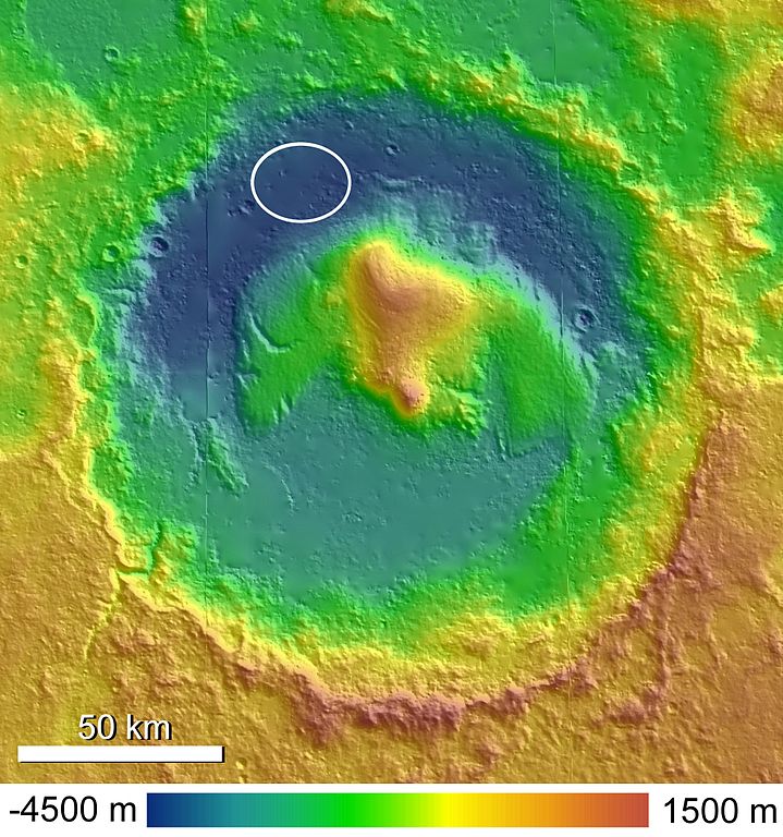
A shaded and colorized topographic map of Gale Crater, Mars, based on publicly released High Resolution Stereo Camera (HRSC) data. The MSL landing ellipse is indicated in the northwestern crater floor.
Polski:
Topograficzna
mapa
krateru Gale
na
Marsie
wykonana metodą cieniowania i kolorowania na podstawie opublikowanych danych stereoskopowej kamery wysokiej rozdzielczości ang.
High Resolution Stereo Camera (HRSC)
. Miejsce lądowania
Mars Science Laboratory
w północno-zachodniej części krateru wskazuje biała elipsa.
|
| Date | |
| Source | Anderson and Bell, 2010 |
| Author | Ryan Anderson |
Licensing
I, the copyright holder of this work, hereby publish it under the following license:
This file is licensed under the
Creative Commons
Attribution-Share Alike 3.0 Unported
license.
-
You are free:
- to share – to copy, distribute and transmit the work
- to remix – to adapt the work
-
Under the following conditions:
- attribution – You must give appropriate credit, provide a link to the license, and indicate if changes were made. You may do so in any reasonable manner, but not in any way that suggests the licensor endorses you or your use.
- share alike – If you remix, transform, or build upon the material, you must distribute your contributions under the same or compatible license as the original.