TodmordenMap1915Atlas.JPG

Size of this preview:
513 × 599 pixels
.
Other resolutions:
205 × 240 pixels
|
525 × 613 pixels
.
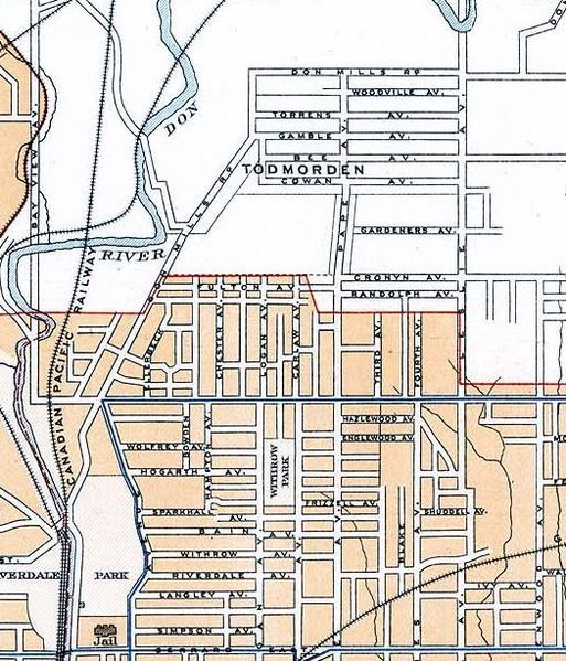
| Description | Map of Todmorden (today East York in Toronto) and what is today the Riverdale neighbourhood. (excerpt of Toronto map) |
| Date | |
| Source | 2nd Edition, 1915, Atlas of Canada (Natural Resources Canada) |
| Author | Government of Canada (Department of the Interior) |
|
Permission
( Reusing this file ) |
Crown Copyright expired (published more than 50 years ago -- see en:Crown copyright#Canada ). May be reproduced, in part or in whole and by any means, without charge or further permission from Natural Resources Canada, subject to: (1)Users exercise due diligence in ensuring the accuracy of the materials reproduced; (2)Natural Resources Canada be identified as the source department; and, (3) The reproduction is not represented as an official version of the materials reproduced, nor as having been made, in affiliation with or with the endorsement of Natural Resources Canada. |
|
|
This
Canadian
work is in the
public domain
in Canada because its copyright has expired due to one of the following:
it was not subject to Crown copyright, and
|

|