Thompson_Chicago_plat_1830.jpg
Size of this preview:
366 × 599 pixels
.
Other resolutions:
146 × 240 pixels
|
293 × 480 pixels
|
959 × 1,570 pixels
.
Summary
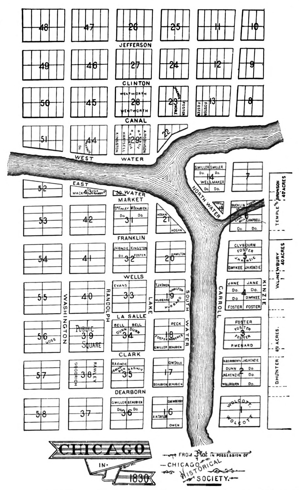
| Description | The Illinois and Michigan Canal Commissioners hired James Thompson, a surveyor from Kaskaskia in downstate Randolph County, to create Chicago's first plat (or map showing proposed lots) in 1830. He laid out the town with straight streets uniformly 66 feet wide (the length of a surveyor's chain) with alleys 16 feet wide bisecting each block. |
| Date | |
| Source | Andreas, Alfred Theodore (1884). History of Chicago. Volume I, page 112. [1] |
| Author | James Thompson |
|
Permission
( Reusing this file ) |
public domain due to date of publication |
| Other versions | [2] |
Licensing
|
|
This media file is in the
public domain
in the
United States
. This applies to U.S. works where the copyright has expired, often because its first
publication
occurred prior to January 1, 1929, and if not then due to lack of notice or renewal. See
this page
for further explanation.
|

|

|
This image might not be in the public domain outside of the United States; this especially applies in the countries and areas that do not apply the
rule of the shorter term
for US works, such as Canada, Mainland China (not Hong Kong or Macao), Germany, Mexico, and Switzerland. The creator and year of publication are essential information and must be provided. See
Wikipedia:Public domain
and
Wikipedia:Copyrights
for more details.
|