Thiram_USA_2012.png

Size of this preview:
462 × 599 pixels
.
Other resolutions:
185 × 240 pixels
|
600 × 778 pixels
.
Summary
| Description |
English:
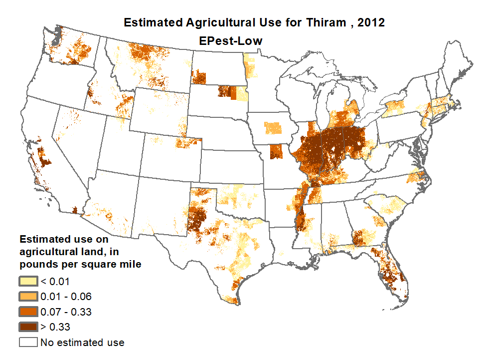
Thiram map of use, USA, 2012 (estimated)
Deutsch:
Geschätzte ausgebrachte Thirammenge in den USA 2012
|
| Date | |
| Source |
Own work http://water.usgs.gov/nawqa/pnsp/usage/maps/graphics/L_THIRAM_2012.png |
| Author | Unknown author |
Licensing
|
|
This image is in the
public domain
in the United States because it only contains materials that originally came from the
United States Geological Survey
, an agency of the
United States Department of the Interior
. For more information, see
the official USGS copyright policy
.
|
|