Thermohaline_Circulation_2.png
Size of this preview:
800 × 502 pixels
.
Other resolutions:
320 × 201 pixels
|
640 × 401 pixels
|
1,100 × 690 pixels
.
Summary
| Description |
English:
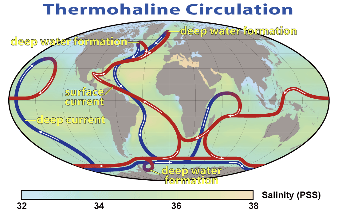
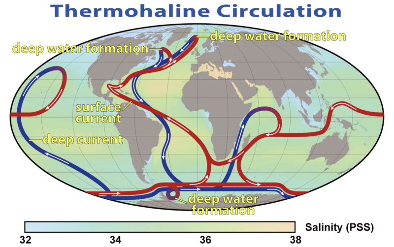
This map shows the pattern of
thermohaline circulation
also known as "meridional overturning circulation". This collection of currents is responsible for the large-scale exchange of water masses in the ocean, including providing oxygen to the
deep ocean
. The entire circulation pattern takes ~2000 years.
Deutsch:
Thermohaline Zirkulation
und die Entstehung von kaltem, dichtem Tiefenwasser im Nordmeer
|
|||||
| Date | ||||||
| Source | NASA Earth Observatory | |||||
| Author | Robert Simmon, NASA. Minor modifications by Robert A. Rohde also released to the public domain | |||||
|
Permission
( Reusing this file ) |
|
|||||
| Other versions |

|


|
This
meteorology
image could be re-created
using
vector graphics
as an
SVG
file
. This has several advantages; see
Commons:Media for cleanup
for more information. If an SVG form of this image is available, please upload it and afterwards replace this template with
{{

vector version available

|

new image name

}}
.
It is recommended to name the SVG file “Thermohaline Circulation 2.svg”—then the template Vector version available (or Vva ) does not need the new image name parameter. |