Thailand_2002_CIA_map.jpg

Size of this preview:
411 × 599 pixels
.
Other resolutions:
165 × 240 pixels
|
329 × 480 pixels
|
527 × 768 pixels
|
703 × 1,024 pixels
|
1,373 × 2,000 pixels
.
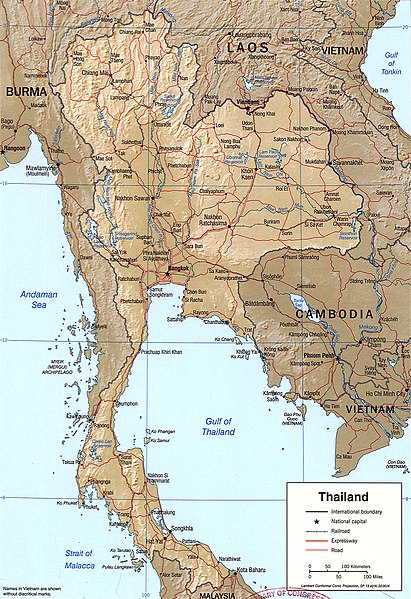
Thailand 2002 CIA map
CREATED/PUBLISHED
[Washington : Central Intelligence Agency?, 2002]
NOTES
Relief shown by shading.
Also shows major roads and expressways.
"Base 802807AI (C00152) 5-02."
Scale [ca. 1:7,000,000] ; Lambert conformal conic proj. (E 97 deg--E 108 deg/N 20 deg--N 6 deg).
SUBJECTS
Thailand--Maps. Roads--Thailand--Maps. Thailand.
MEDIUM
1 map : col. ; 25 x 17 cm.
CALL NUMBER== G8026.P2 2002 .U51
REPOSITORY
Library of Congress Geography and Map Division Washington, D.C. 20540-4650 USA
DIGITAL ID
g8026p ct001590 http://hdl.loc.gov/loc.gmd/g8026p.ct001590
|
|
This image is a work of a
Central Intelligence Agency
employee, taken or made as part of that person's official duties. As a Work of the United States Government, this image or media is in the
public domain
in the United States.
|

|