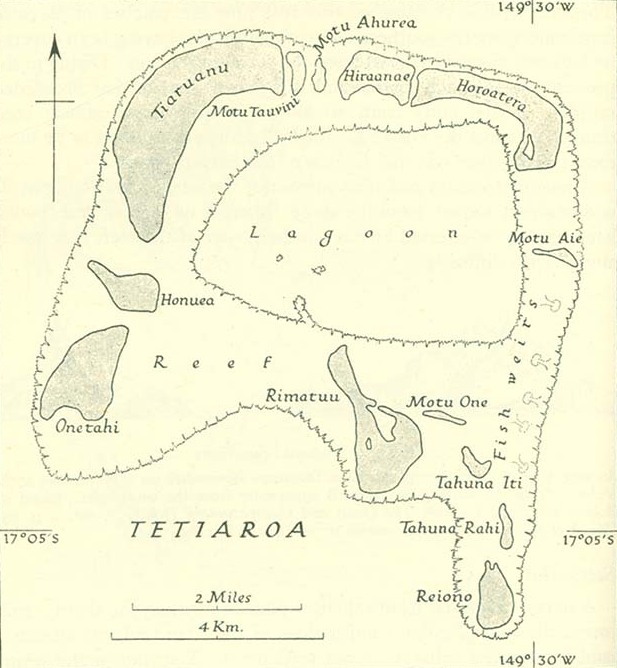
Tetiaroa.jpg
Size of this preview:
554 × 600 pixels
.
Other resolutions:
222 × 240 pixels
|
617 × 668 pixels
.
Summary
http://www.lib.utexas.edu/maps/historical/pacific_islands_1943_1945/tetiaroa.jpg
Public domain, as explained on page http://www.lib.utexas.edu/usage_statement.html?maps=yes : "Most of the maps scanned by the University of Texas Libraries and served from this web site are in the public domain. No permissions are needed to copy them. You may download them and use them as you wish. A few maps are copyrighted, and are clearly marked as such."
The motu of Tahuna Iti and the sandbank of Motu One are interchanged on the map.
Licensing
|
|
This file is in the
public domain
because
it has been taken from a collection of public domain maps at the University of Texas Library
|