Sunnibergbruecke_nord.jpg

Size of this preview:
800 × 533 pixels
.
Other resolutions:
320 × 213 pixels
|
640 × 427 pixels
|
1,024 × 683 pixels
|
1,280 × 853 pixels
|
2,560 × 1,707 pixels
|
3,456 × 2,304 pixels
.
| Description |
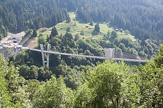
Deutsch:
Die Sunniberbgrücke zwischen Serneus und Klosters Dorf, Schweiz; Aufnahme von der alten Hauptstrasse aus
|
| Date | |
| Source | Own work |
| Author | Ikiwaner |
| Camera location |
|
View this and other nearby images on: OpenStreetMap |
|
|---|

|
Permission is granted to copy, distribute and/or modify this document under the terms of the GNU Free Documentation License , Version 1.2 or any later version published by the Free Software Foundation ; with no Invariant Sections, no Front-Cover Texts, and no Back-Cover Texts. A copy of the license is included in the section entitled GNU Free Documentation License . |
|
|
This file is licensed under the Creative Commons Attribution-Share Alike 3.0 Unported license. | |
|
||
| This licensing tag was added to this file as part of the GFDL licensing update . |
