Sunderland_South_Docks_June_1969.jpg
Size of this preview:
734 × 599 pixels
.
Other resolutions:
294 × 240 pixels
|
588 × 480 pixels
|
1,020 × 833 pixels
.
Summary
| Description |
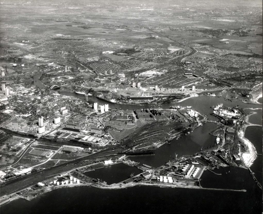
Hendon Dock in the foreground was completed in 1868 as an extension to the larger Hudson Docks opened in 1850. Bartram & Sons shipyard can be seen, lower right, next to the oil storage depot. Reference: TWAS: DT.TUR.7.15 (Copyright) We're happy for you to share this digital image within the spirit of The Commons. Please cite 'Tyne & Wear Archives & Museums' when reusing. Certain restrictions on high quality reproductions and commercial use of the original physical version apply though; if you're unsure please email [email protected]. To purchase a hi-res copy please email [email protected] quoting the title and reference number |
| Date | |
| Source |
Sunderland South Docks June 1969
|
| Author | TWAM - Tyne & Wear Archives & Museums |
|
Permission
( Reusing this file ) |
TWAM - Tyne & Wear Archives & Museums @ Flickr Commons |
| Camera location |
|
View this and other nearby images on: OpenStreetMap |
|
|---|
Licensing
|
This image was taken from
Flickr
's
The Commons
. The uploading organization may have various reasons for determining that
no known copyright restrictions
exist, such as:
More information can be found at https://flickr.com/commons/usage/ . Please add additional copyright tags to this image if more specific information about copyright status can be determined. See Commons:Licensing for more information. |
|
|
This image, originally posted to Flickr , was reviewed on July 6, 2011 by the administrator or reviewer File Upload Bot (Magnus Manske) , who confirmed that it was available on Flickr under the stated license on that date. |