Sumdorong-Chu.jpg

Size of this preview:
800 × 462 pixels
.
Other resolutions:
320 × 185 pixels
|
640 × 370 pixels
|
1,288 × 744 pixels
.
Summary
| Description |
English:
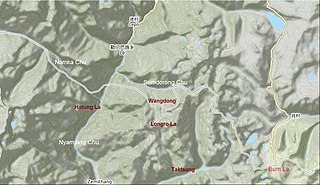
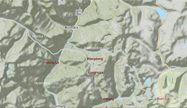
OpenStreetMap screenshot of the
Sumdorong Chu
valley and vicinity. The
w:Line of Actual Control
between China and India as marked by OpenStreetMap contributors as of January 2021.
|
| Date | |
| Source | https://www.openstreetmap.org/#map=12/27.7649/91.7607&layers=C |
| Author | Contributors to the OpenStreetMap |
Licensing
This file is licensed under the
Creative Commons
Attribution-Share Alike 2.0 Generic
license.
-
You are free:
- to share – to copy, distribute and transmit the work
- to remix – to adapt the work
-
Under the following conditions:
- attribution – You must give appropriate credit, provide a link to the license, and indicate if changes were made. You may do so in any reasonable manner, but not in any way that suggests the licensor endorses you or your use.
- share alike – If you remix, transform, or build upon the material, you must distribute your contributions under the same or compatible license as the original.
|
|
This work contains information from
OpenStreetMap
, which is made available under the
Open Database License (ODbL)
.
The ODbL does not require any particular license for maps produced from ODbL data. Prior to 1 August 2020, map tiles produced by the OpenStreetMap Foundation were licensed under the CC-BY-SA-2.0 license . Maps produced by other people may be subject to other licences. |