Stromness-Bay.jpg

Size of this preview:
800 × 493 pixels
.
Other resolutions:
320 × 197 pixels
|
640 × 394 pixels
|
1,024 × 631 pixels
|
1,280 × 789 pixels
|
1,792 × 1,104 pixels
.
Summary
- Description
English:
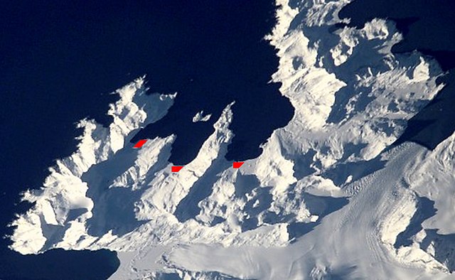
Satellite image of central
South Georgia Island
-
Antarctic region
.
- Stromness Bay: with Husvik, Stromness, and Leith Harbours; and peninsulas.
- Image
- Science and Analysis Laboratory, NASA-Johnson Space Center. "The Gateway to Astronaut Photography of Earth."
< http://eol.jsc.nasa.gov/scripts/sseop/QuickView.pl?directory=ESC&ID=ISS002-E-10079 > (10/01/2007 15:24:24)
Source [1]
|
|
This image or video was catalogued by one of the centers of the United States
National Aeronautics and Space Administration
(NASA) under
Photo ID:
ISS002-E-10079
.
This tag does not indicate the copyright status of the attached work. A normal copyright tag is still required. See Commons:Licensing .
Other languages:
|
Licensing
|
|
This file is in the public domain in the United States because it was solely created by NASA . NASA copyright policy states that "NASA material is not protected by copyright unless noted ". (See Template:PD-USGov , NASA copyright policy page or JPL Image Use Policy .) |
|

|
Warnings:
|
| Annotations | This image is annotated: View the annotations at Commons |