Stewart_Island_map-en.svg

Size of this PNG preview of this SVG file:
800 × 585 pixels
.
Other resolutions:
320 × 234 pixels
|
640 × 468 pixels
|
1,024 × 748 pixels
|
1,280 × 936 pixels
|
2,560 × 1,871 pixels
|
2,237 × 1,635 pixels
.
Summary
| Description |
English
:
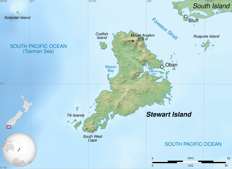
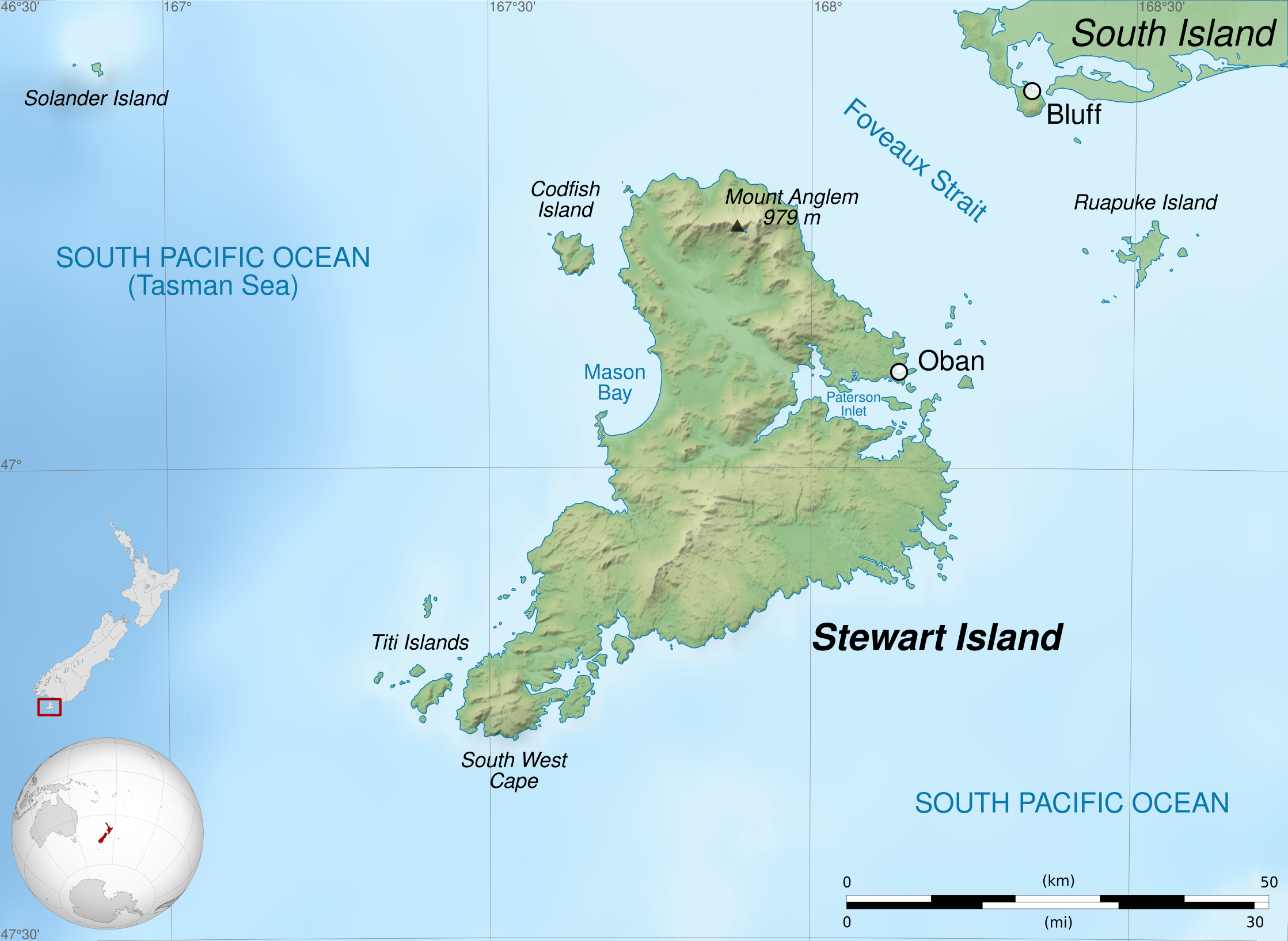
Map of
Stewart Island / Rakiura
, New Zealand.
Geographic limits of the map:
Français
:
Carte de l'
île Stewart
, au sud de la Nouvelle-Zélande.
Limites géographiques de la carte :
|
||
| Date | |||
| Source |
Own work .
English
:
Français
:
|
||
| Author | Sémhur ( talk ) | ||
| Other versions |
|
||
|
Attribution
( required by the license ) |
© Sémhur / Wikimedia Commons / | ||
| SVG |
W3C-validity not checked.
|
||
| Graphic Lab |


| Camera location |
|
View this and other nearby images on: OpenStreetMap |
|
|---|
Licensing
I, the copyright holder of this work, hereby publish it under the following licenses:
|
|
Copyleft: This work of art is free; you can redistribute it and/or modify it according to terms of the Free Art License . You will find a specimen of this license on the Copyleft Attitude site as well as on other sites . |
This file is licensed under the
Creative Commons
Attribution-Share Alike
Attribution-Share Alike 4.0 International
,
3.0 Unported
,
2.5 Generic
,
2.0 Generic
and
1.0 Generic
license.
-
You are free:
- to share – to copy, distribute and transmit the work
- to remix – to adapt the work
-
Under the following conditions:
- attribution – You must give appropriate credit, provide a link to the license, and indicate if changes were made. You may do so in any reasonable manner, but not in any way that suggests the licensor endorses you or your use.
- share alike – If you remix, transform, or build upon the material, you must distribute your contributions under the same or compatible license as the original.
You may select the license of your choice.