St_Ninian's_-_geograph.org.uk_-_9511.jpg
No higher resolution available.
|
This is a photo of
listed building
number
1326778
.
|
Summary
| Description |
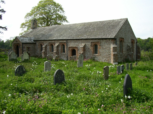
English:
St Ninian's parish church, Brougham, Cumbria. Known locally as Ninekirks, the church down a long track, in fields above a bend in the River Eamont. The original, possibly Norman, church on this site was completely rebuilt in the 17th century for Lady Anne Clifford, who had inherited Brougham Castle as part of her family estates. The church remains almost unaltered since then.
|
| Date | |
| Source | From geograph.org.uk |
| Author | Ken Brown |
|
Attribution
( required by the license ) |
Ken Brown / St Ninian's / |
| Object location |
|
View this and other nearby images on: OpenStreetMap |
|
|---|
_&language=en)
Licensing

|
This image was taken from the
Geograph project
collection. See
this photograph's page
on the Geograph website for the photographer's contact details. The copyright on this image is owned by
Ken Brown
and is licensed for reuse under the
Creative Commons
Attribution-ShareAlike 2.0 license.
|
This file is licensed under the
Creative Commons
Attribution-Share Alike 2.0 Generic
license.
Attribution:
Ken Brown
-
You are free:
- to share – to copy, distribute and transmit the work
- to remix – to adapt the work
-
Under the following conditions:
- attribution – You must give appropriate credit, provide a link to the license, and indicate if changes were made. You may do so in any reasonable manner, but not in any way that suggests the licensor endorses you or your use.
- share alike – If you remix, transform, or build upon the material, you must distribute your contributions under the same or compatible license as the original.