Solomon_Islands-CIA_WFB_Map.png
Licensing
Description Solomon Islands-CIA WFB Map.png |
English:
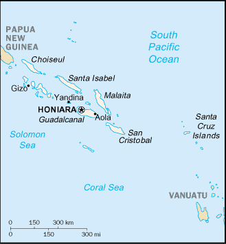
Map of Solomon Islands, showing major towns.
|
||||
Date | |||||
Source | CIA, The World Factbook , 2004 (internet version) | ||||
Author | CIA | ||||
Permission
( Reusing this file ) |
|
||||
Other versions |
|
This file is an
original
and
may
be
obsolete
for general use, but is kept for historical or archival use. As such, it should not be modified or deleted except to correct upload or technical errors.
Any modified versions or replacements of this image should be uploaded with a different file name.
Information about this file: 2004 version العربيَّة ∙ čeština ∙ Deutsch ∙ English ∙ español ∙ فارسی ∙ français ∙ magyar ∙ italiano ∙ 日本語 ∙ Lëtzebuergesch ∙ македонски ∙ മലയാളം ∙ Nederlands ∙ português ∙ русский ∙ slovenščina ∙ svenska ∙ 简体中文 ∙ 繁體中文 ∙ 正體中文(臺灣) ∙ +/− |