Skypan600.jpg
Size of this preview:
800 × 188 pixels
.
Other resolutions:
320 × 75 pixels
|
640 × 150 pixels
|
2,269 × 533 pixels
.
Summary
| Description |
English:
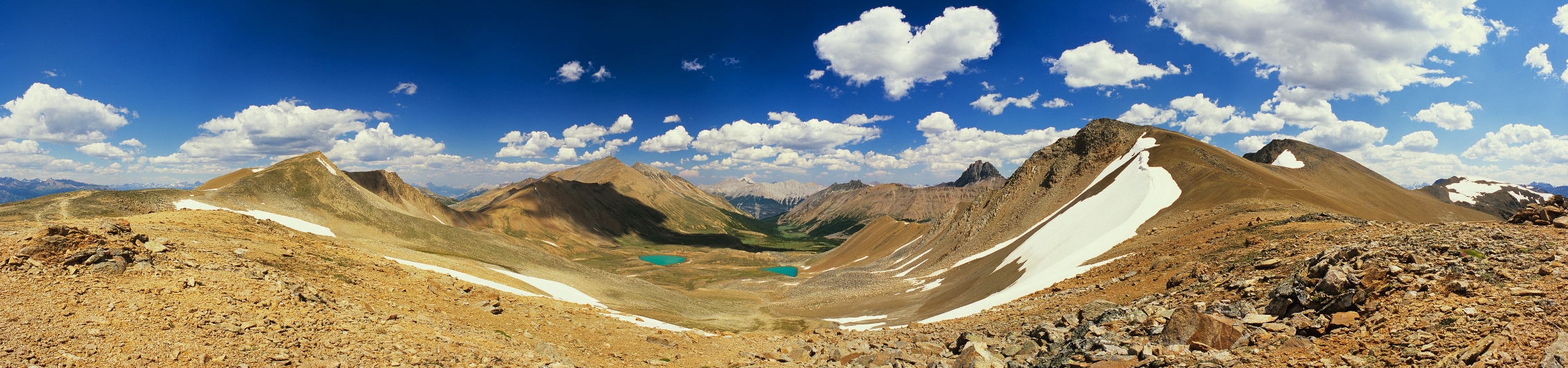
Skyline trail, Jasper National Park 180 degree panorama. The trail is running roughly north-south, and can be seen on the left and right sides of the panorama. The city of Jasper lies in the valley to the north (left side of the panorama) and is not visible. Mt. Robson is just visible to the north as the highest peak on the horizon
|
| Source | Own work |
| Author | Touque |
Licensing
I, the copyright holder of this work, hereby publish it under the following licenses:
This file is licensed under the
Creative Commons
Attribution-Share Alike 3.0 Unported
license.
-
You are free:
- to share – to copy, distribute and transmit the work
- to remix – to adapt the work
-
Under the following conditions:
- attribution – You must give appropriate credit, provide a link to the license, and indicate if changes were made. You may do so in any reasonable manner, but not in any way that suggests the licensor endorses you or your use.
- share alike – If you remix, transform, or build upon the material, you must distribute your contributions under the same or compatible license as the original.

|
Permission is granted to copy, distribute and/or modify this document under the terms of the GNU Free Documentation License , Version 1.2 or any later version published by the Free Software Foundation ; with no Invariant Sections, no Front-Cover Texts, and no Back-Cover Texts. A copy of the license is included in the section entitled GNU Free Documentation License . |
You may select the license of your choice.
| Annotations | This image is annotated: View the annotations at Commons |