SkylinePark.jpg

Size of this preview:
800 × 416 pixels
.
Other resolutions:
320 × 166 pixels
|
640 × 333 pixels
|
1,024 × 532 pixels
|
1,280 × 665 pixels
|
2,296 × 1,193 pixels
.
Summary
| Description |
English:
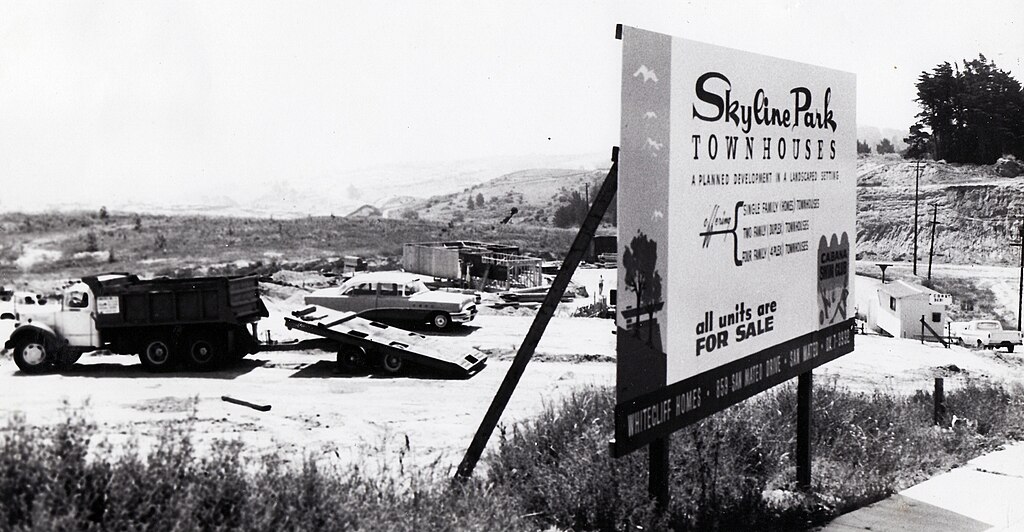
Skyline Park was the final subdivision developed in the Crestmoor district of San Bruno, in 1966-67. Grading for the Junipero Serra Freeway (I-280) leveled the hill seen on the right side of this photo.
|
| Location | San Bruno |
| Date | 15 September 2007 (original upload date) |
| Source | San Bruno Herald |
| Author | Robert E. Nylund ( User:Sallyrob ) |
Licensing
|
|
This work has been released into the
public domain
by its author,
Sallyrob
at
English Wikipedia
. This applies worldwide.
In some countries this may not be legally possible; if so: Sallyrob grants anyone the right to use this work for any purpose , without any conditions, unless such conditions are required by law. |
Original upload log
Transferred from en.wikipedia to Commons using For the Common Good .
The original description page was
here
. All following user names refer to en.wikipedia.
| Date/Time | Dimensions | User | Comment |
|---|---|---|---|
| 18:06, 15 September 2007 | 2,316 × 1,193 (621,290 bytes) | w:en:Sallyrob ( talk | contribs ) | *Author:Robert E. Nylund *Source:San Bruno Herald photos |