ShorehamChurch(BobEmbleton)Apr2006.jpg
No higher resolution available.
|
This is a photo of
listed building
number
1192780
.
|
Summary
| Description |
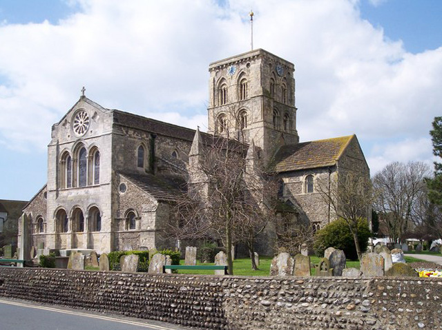
English:
Shoreham Church The earlier settlement (now called Old Shoreham)is further up the river adur. In the 11th century the Norman's established the new Shoreham as an important haven laid out on a rectangular grid. The church of St. Mary de Haura is dated AD 1103.
|
| Date | |
| Source |
This file was derived from:
Shoreham Church - geograph.org.uk - 156737.jpg
|
| Author | Bob Embleton |
| Camera location |
|
View this and other nearby images on: OpenStreetMap |
|
|---|
Apr2006.jpg¶ms=050.832670_N_-000.274626_E_globe:Earth_type:camera_heading:225.00&language=en)
Licensing
This file is licensed under the
Creative Commons
Attribution-Share Alike 2.0 Generic
license.
Attribution:
Bob Embleton
-
You are free:
- to share – to copy, distribute and transmit the work
- to remix – to adapt the work
-
Under the following conditions:
- attribution – You must give appropriate credit, provide a link to the license, and indicate if changes were made. You may do so in any reasonable manner, but not in any way that suggests the licensor endorses you or your use.
- share alike – If you remix, transform, or build upon the material, you must distribute your contributions under the same or compatible license as the original.