Shipton-Tilman_1934_Garhwal_routes.svg

Size of this PNG preview of this SVG file:
707 × 599 pixels
.
Other resolutions:
283 × 240 pixels
|
566 × 480 pixels
|
906 × 768 pixels
|
1,208 × 1,024 pixels
|
2,416 × 2,048 pixels
|
1,169 × 991 pixels
.
Summary
| Description |
English:
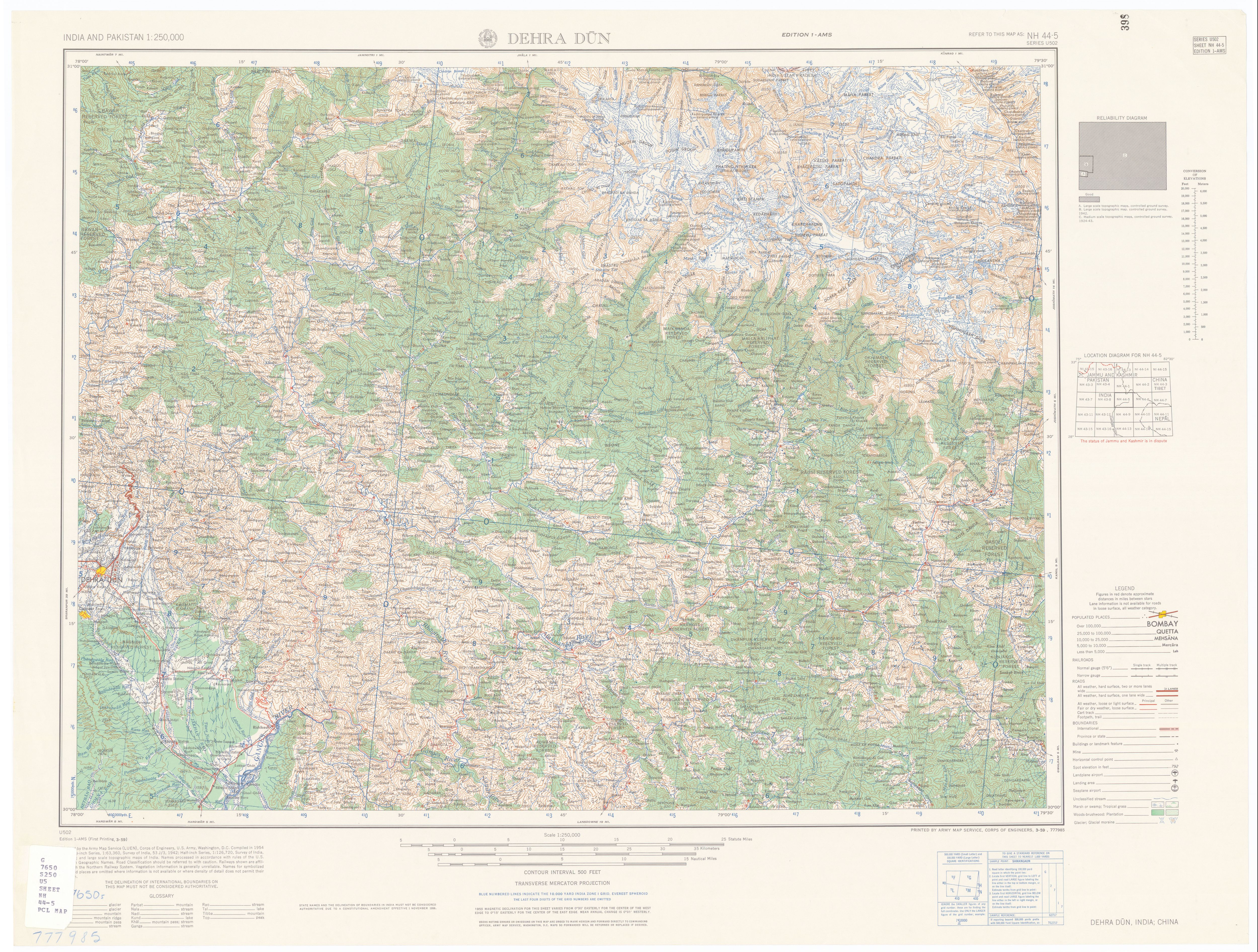
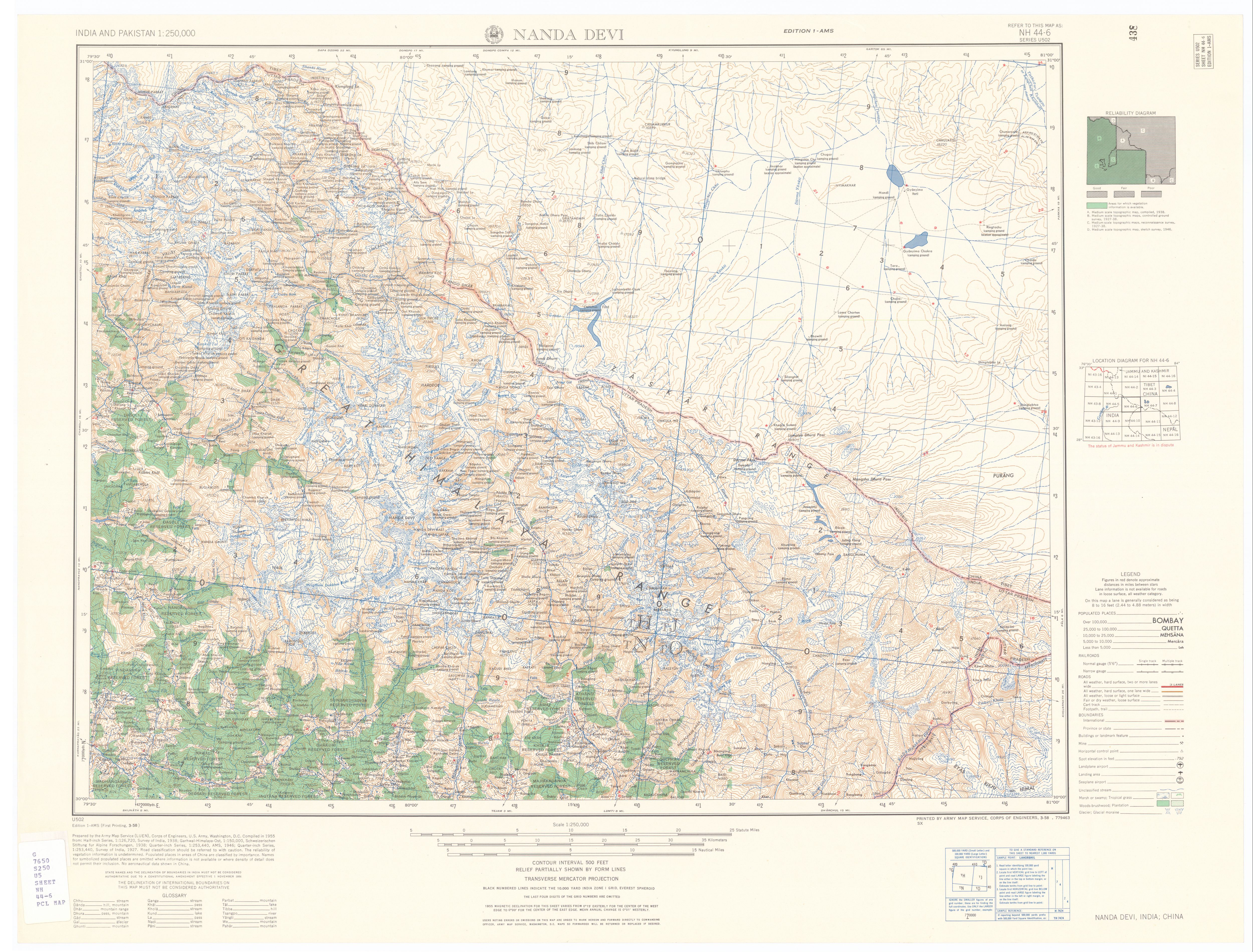
Map of routes taken on their 1934 Garwhal expedition.
Based mainly on Perrin (2013) "Shipton & Tilman" Hutchinson and
http://www.lib.utexas.edu/maps/ams/india/nh-44-05.jpg
and
http://www.lib.utexas.edu/maps/ams/india/nh-44-06.jpg
Shipton calls Chaukhamba "Kunaling" |
| Date | |
| Source | Own work |
| Author | Thincat |
Licensing
I, the copyright holder of this work, hereby publish it under the following license:
This file is licensed under the
Creative Commons
Attribution-Share Alike 4.0 International
license.
-
You are free:
- to share – to copy, distribute and transmit the work
- to remix – to adapt the work
-
Under the following conditions:
- attribution – You must give appropriate credit, provide a link to the license, and indicate if changes were made. You may do so in any reasonable manner, but not in any way that suggests the licensor endorses you or your use.
- share alike – If you remix, transform, or build upon the material, you must distribute your contributions under the same or compatible license as the original.