Shakemap_Ecuador_April_2016.jpg
Size of this preview:
456 × 599 pixels
.
Other resolutions:
183 × 240 pixels
|
365 × 480 pixels
|
762 × 1,001 pixels
.
Summary
| Description |
English:
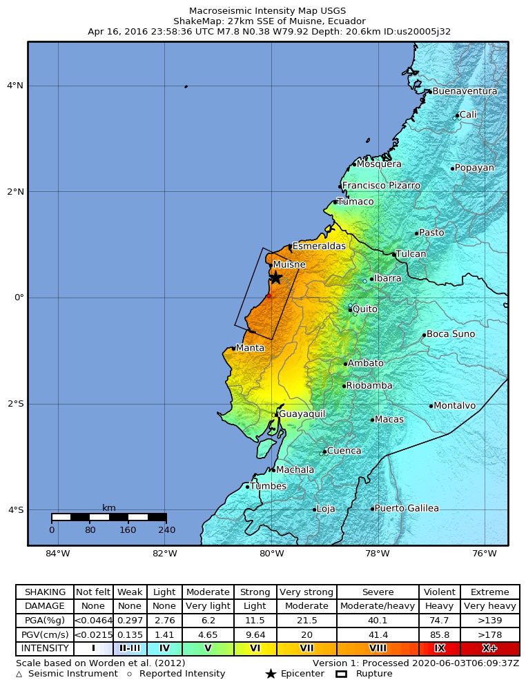
Shakemap for the 2016 Ecuador earthquake
Español:
Mapa de intensidades sísmicas para el terremoto de Ecuador de 2016
Magyar:
A 2016-os ecuadori földrengés rengéseinek térképe
|
| Date | |
| Source | https://earthquake.usgs.gov/earthquakes/eventpage/us20005j32#shakemap |
| Author | United States Geological Survey |
Licensing
|
|
This image is in the
public domain
in the United States because it only contains materials that originally came from the
United States Geological Survey
, an agency of the
United States Department of the Interior
. For more information, see
the official USGS copyright policy
.
|
|