Severn_Barrages_map.svg

Size of this PNG preview of this SVG file:
800 × 579 pixels
.
Other resolutions:
320 × 232 pixels
|
640 × 464 pixels
|
1,024 × 742 pixels
|
1,280 × 927 pixels
|
2,560 × 1,854 pixels
|
932 × 675 pixels
.
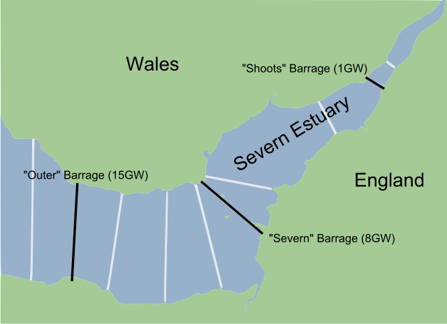
| Description | A map of various plans to put some sort of w:barrage across the w:River Severn , including the three main plans. The numbers in brackets represents peak flow generating capacity, in GW (where one GW represents 1 million watts); in comparison, average UK demand is around 40GW. | ||
| Date | Created 5 March 2010, with information from the period 2007–8. | ||
| Source | Created from w:File:Severn_estuary_barrages.png , a work by w:User:Fig wright released into the public domain. | ||
| Author | Jarry1250 (derivative of w:User:Fig wright ) | ||
|
Permission
( Reusing this file ) |
|