Scotland_sections_of_Munro's_tables.png

Size of this preview:
433 × 599 pixels
.
Other resolutions:
173 × 240 pixels
|
347 × 480 pixels
|
555 × 768 pixels
|
740 × 1,024 pixels
|
2,109 × 2,916 pixels
.
Summary
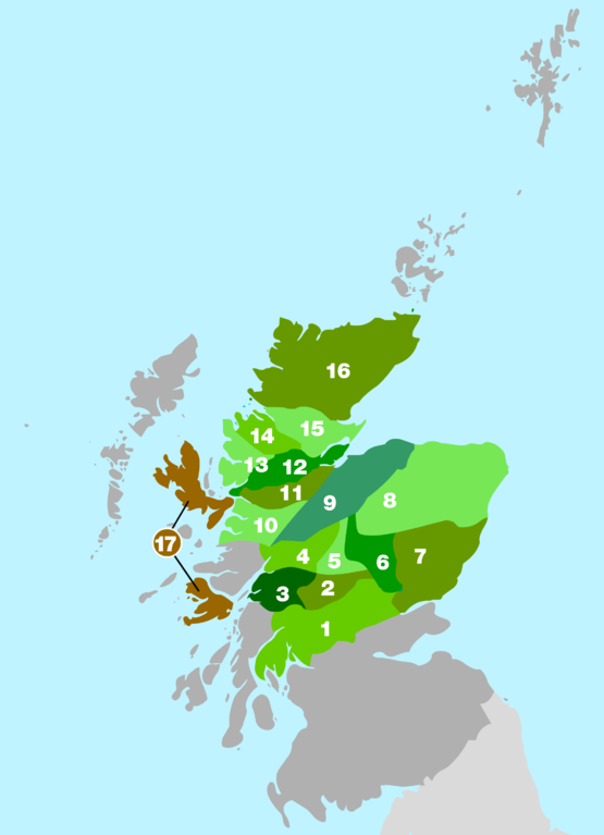
| Description |
English:
Rough outline of the areas used in Munro's 1891 tables to divide up the mountain ranges of Scotland. Map based on information in the 2006 edition of
The Munros - SMC Hillwalkers' Guide
ISBN
0907521940
|
| Source | Own work |
| Author | Cnbrb |
Licensing
|
|
I, the copyright holder of this work, release this work into the
public domain
. This applies worldwide.
In some countries this may not be legally possible; if so: I grant anyone the right to use this work for any purpose , without any conditions, unless such conditions are required by law. |