Saxon.emigration.5th.cen.jpg

Size of this preview:
645 × 600 pixels
.
Other resolutions:
258 × 240 pixels
|
516 × 480 pixels
|
826 × 768 pixels
|
1,101 × 1,024 pixels
|
2,301 × 2,140 pixels
.
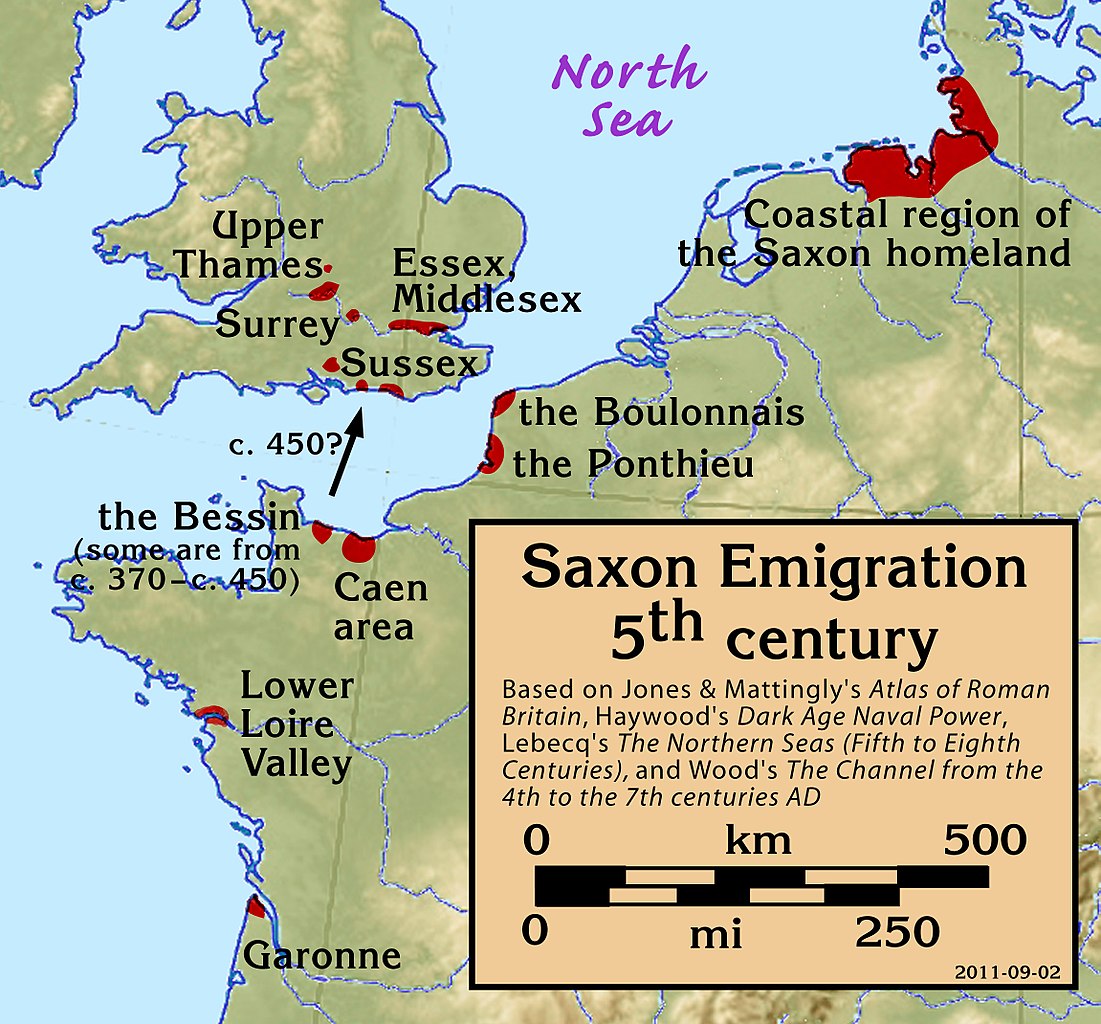
| Description | Saxon Emigration in the 5th century |
| Date | |
| Source |
Based on Jones & Mattingly's
Atlas of Roman Britain
(ISBN 978-1-84217-06700, 1990, reprinted 2007, pp. 317, 318), Haywood's
Dark Age Naval Power
(
ISBN
1-898281-43-2
, 1999, pp. 84–86, 121), Lebecq's
The Northern Seas (fifth to eighth centuries)
(in
The New Cambridge Medieval History
, Vol I c.500–c.700, ISBN 13-978-0-521-36291-7, 2005, p. 643), and Wood's
The Channel from the 4th to the 7th centuries AD
in Carver's
Maritime Celts, Frisians and Saxons
(
ISBN
978-0906780930
, pp 93–97). The suggestion that settlements on the south coast of Britain were made from the Bessin is from Haywood (Vron, for example, was abandoned c. 450).
|
| Author | my work |
I, the copyright holder of this work, hereby publish it under the following license:
This file is licensed under the
Creative Commons
Attribution-Share Alike 3.0 Unported
license.
-
You are free:
- to share – to copy, distribute and transmit the work
- to remix – to adapt the work
-
Under the following conditions:
- attribution – You must give appropriate credit, provide a link to the license, and indicate if changes were made. You may do so in any reasonable manner, but not in any way that suggests the licensor endorses you or your use.
- share alike – If you remix, transform, or build upon the material, you must distribute your contributions under the same or compatible license as the original.