Satellitemarion.jpg
No higher resolution available.
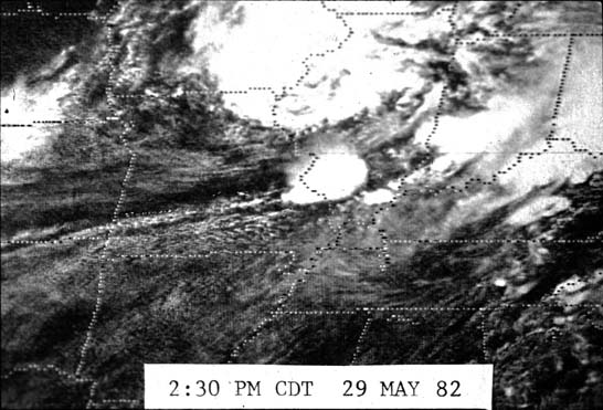
Summary
| Description | Satellite picture of the clouds that produced the Marion, Illinois tornado . |
| Date | 29 May 1982 14:30 CDT ; 30 December 2007 (original upload date) |
| Source | http://www.crh.noaa.gov/pah/?n=1982_Photos |
| Author | National Weather Service |
|
Permission
( Reusing this file ) |
Public domain |
Licensing
|
|
This image is in the
public domain
because it contains materials that originally came from the U.S.
National Oceanic and Atmospheric Administration
, taken or made as part of an employee's official duties.
|
|