Sarcophagus_of_Ankhnesneferibre.jpg
Size of this preview:
341 × 600 pixels
.
Other resolutions:
136 × 240 pixels
|
273 × 480 pixels
|
436 × 768 pixels
|
582 × 1,024 pixels
|
1,994 × 3,508 pixels
.
| Camera location |
|
View this and other nearby images on: OpenStreetMap |
|
|---|
| Photographer |
Hans Hillewaert
|
| Description |
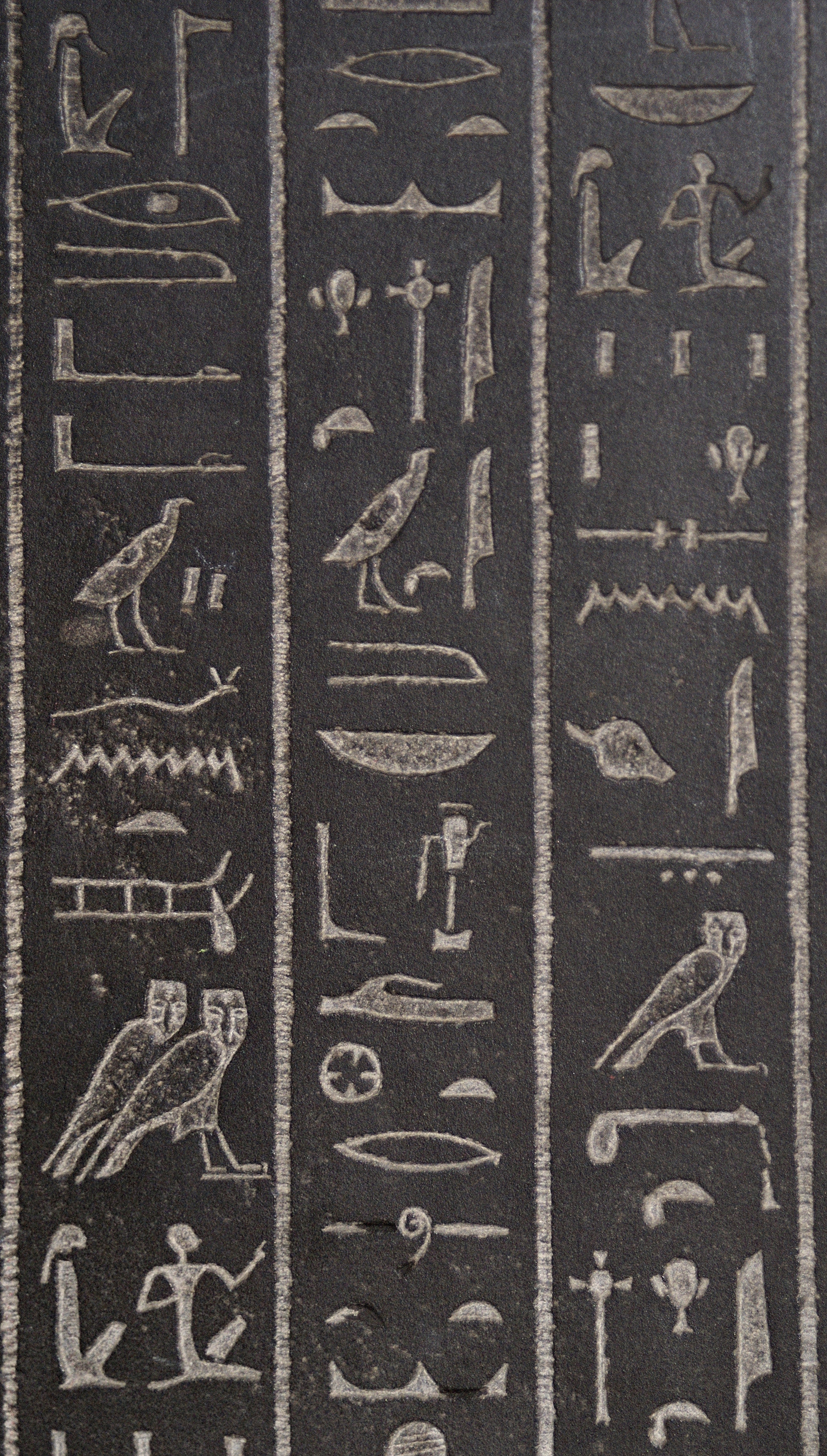
English:
Detail from the side of the Sarcophagus of Ankhnesneferibre from the Twenty-Sixth Dynasty, about 530 BC, Thebes, at the
British Museum
.
Egyptian hieroglyphs: (Read from column right, to the left-(columns, 3-2-1(last)-(into the facing direction of hieroglyphs)) Column 3: Man and Worman , Strip of Land, with Grains Column 2: Vertical-Cross , Water Libation Pot-(or:-(hs) hieroglyph) Column 1: Sled of God Tem , Vertical-Cross , Man and Worman |
| Date | 21 November 2007 |
| Source | Own work |
|
Permission
( Reusing this file ) |
This file is licensed under the
Creative Commons
Attribution-Share Alike 4.0 International
license.
Attribution:
© Hans Hillewaert
|
| Other licenses |
More (4100+) and new images on :
High resolution files on request. . |
|
Attribution
( required by the license ) |
© Hans Hillewaert / |
|
|
This image has been assessed using the
Quality image guidelines
and is considered a
Quality image
.
|